2017 - Park City, Alaska round trip by motorcycle
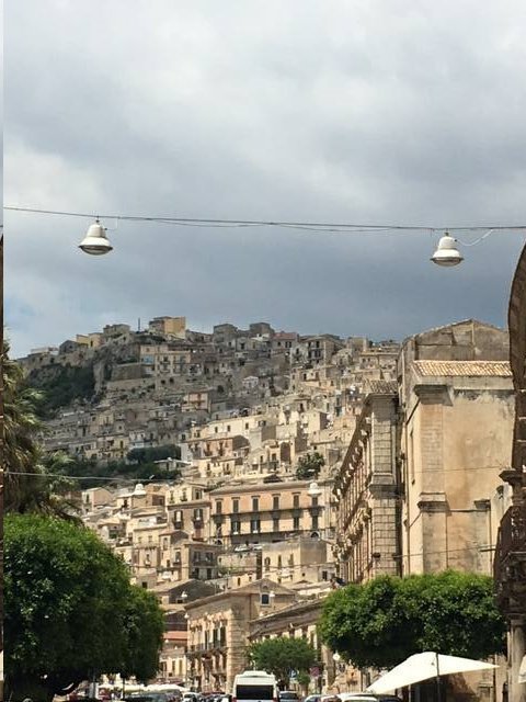
Above: Modica, Sicily. 28 May 2017.
TIMDT and cronies in Sicily.
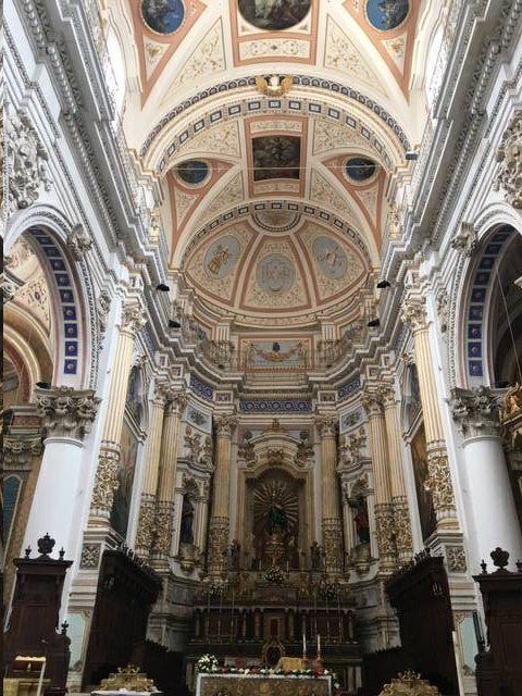
Above: Duomo di San Pietro Modica. Modica, Sicily. 28 May 2017.
TIMDT and cronies in Sicily.
Above: Bishop's luggage on BMW F800GS motorcycle. 28 May 2017.
Start.
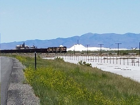
Above: Union Pacific ore train passes Morton Salt plant on Great Salt Lake. Mile Marker 87. I-80 westbound. Utah. 28 May 2017.
Wonderful to be back on the motorcycle. I love Utah's west desert. So isolated... pungent with the smell of well watered sage brush. Long vistas. Stark... hostile... and beautiful at the same time.
Great atmospheric clarity today. As I ride to the west of this point, fully 70 miles east of the Utah/Nevada state line, I can see Mt. Haystack in the Deep Creeks at 11 o'clock and Pilot Peak, in the Pilot Range at 2 o'clock. Both peaks are very near the state line, but Haystack is in Utah and Pilot Peak is in Nevada.
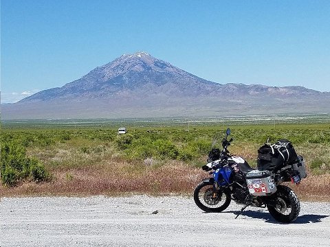
Above: F800GS and Pilot Peak. Northwest of Wendover, UT/NV. I-80, westbound.
Iconic peak just west of Utah state line north of Wendover. In pioneer times, anyone attempting to cross Great Salt Lake Desert, coming from the east, used Pilot Peak (hence the name) as the end point of the 80 mile, waterless desert crossing... and, the source of spring water throughout the year.
Pilot Peak appears in the writings of Kit Carson, John C. Fremont, and Jed Smith.
In the late '90's I did a lot of off road motorcycle riding in the immediate area. The bar in Montello, NV has great burgers.
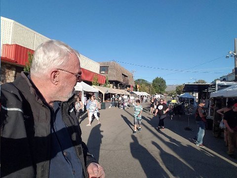
Above: Run A Mucca motorcycle rally. Winnemucca, NV. 28 May 2017.
It was Sunday afternoon and the rally was winding down. It was well attended... I saw 800 Facebook check ins the next day. There were a few people there when I arrived. Lotta bikes in the parking lot and riding around town. No F800GS's though!
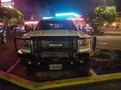
Above: Chevy truck with cattle guard and lighting array. Winnemucca Inn. Winnemucca, NV 28 May 2017.
Last night.
Now this... is what I'm talkin' 'bout!
TIMDT says if I get something like this for my F350 she won't ride in it any more.
Bud, my grandson says, "Grandpa, its your money. Just go out and get it! She'll get over it after a while." I said, "if I bought that stuff, not only would she not ride in the truck, but, it would cost me 5x the value of the installation in diamonds." Then I go on... 'marriage is about compromise. You can't get everything that you want."
Addendum:
Steve
If you just completed 96 days this year, 100 days is so close are you sure you are bailing out?
Did TIMDT visit with the president in Sicily??
The POPE,
Tallahassee, FL
She was there the day after.
Steve,
I always enjoy getting your emails, from which I always learn something new. THANKS!
Currently spending a few weeks at my sister’s cabin in the high mountains in Norway with beautiful weather.
Greetings
Norway, Med vennlig hilsen, Norway
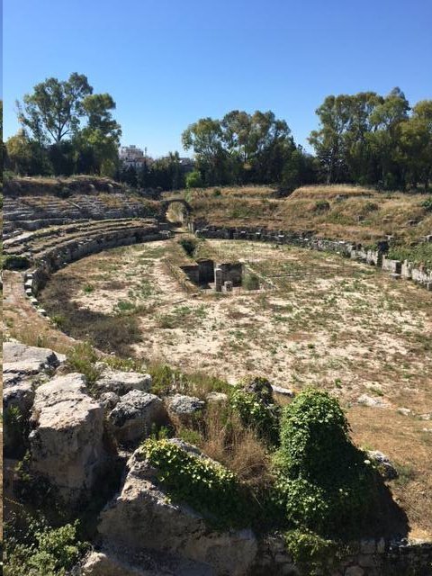
Above: Archaeological Park. Siricusa, Sicily. 29 May 2017.
TIMDT and cronies in Sicily.
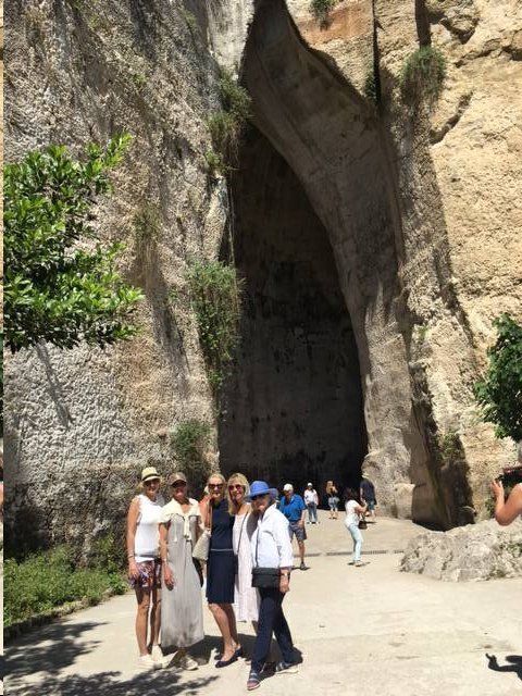
Above: Ear of Dionysius. TIMDT and cronies. Syracuse, Sicily. 29 May 2017.
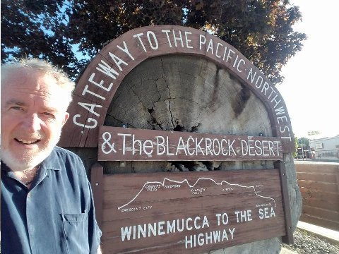
Above: Bishop at start of "Winnemucca to the Sea Highway. Winnemucca, NV. 29 May 2017.
AM walk around town. Bishop channels Butch Cassidy, who robbed
a bank here.
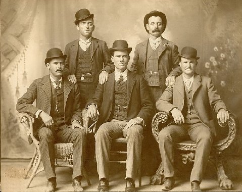
Wikipedia:
Cassidy, Longabaugh, and Carver traveled to Winnemucca, Nevada, where on September 19, 1900, they robbed the First National Bank of $32,640. In December, Cassidy posed alongside Longabaugh, Logan, Carver, and Ben Kilpatrick in Fort Worth, Texas for the now-famous "Fort Worth Five" photograph.[16] The Pinkerton Detective Agency obtained a copy of the photograph and began to use it for wanted posters.
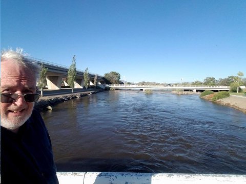
Above: Bishop and the Humboldt River. Winnemucca, NV. 29 May 2017.
The mighty Humboldt River. Not at flood, but running as high as I have seen.
In mid 19th century, California pioneers and gold miners, trekking West, picked up the Humbolt (draining obscure ranges, like the Jarbidge in southern Idaho and Northern Nevada) near present day Elko, NV. They had come from southern Idaho by way of Fort Hall and City of Rocks. The Idaho route, though longer, had water and avoided the Great Salt Lake and it's stark, waterless desert.
The Donner Party hoping to benefit from the faster route West , directly across the Great Salt Lake Desert, learned the perils of their decision the hard way: They lost half their herd and had to give up much equipment and stores to make it across the desert. Adventure types willing to follow the Donner desert track today can still find abandoned Donner relics in the salt and sand.
The California bound pioneers followed the Humboldt across Nevada for 200 miles to the Humboldt Sink, where the water was soaked up by the desert.
The Truckee River was 50 miles further East from the Humboldt Sink, and the Sierra another 35 miles beyond that. 50 waterless miles was doable.
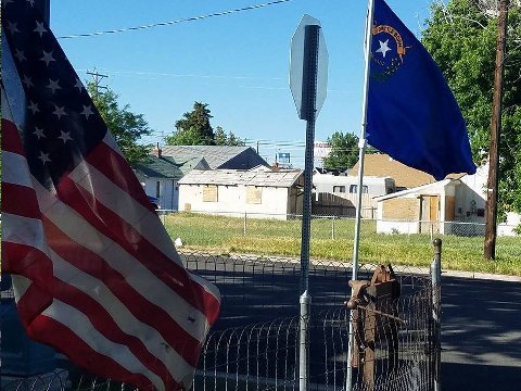
Above: Winnemucca honors Vets. Winnemucca, NV. 29 May 2017.
Addendum:
You are amazing, on The road again. I am cruising to the Amazon on Regent and went zip lining in St. Lucia on the way. Your trip had far better sights
Bridge,
Palm Beach, FL
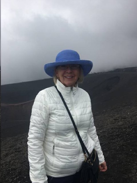
Above: TIMDT at Mt Etna, Sicily. 29 May 2017.
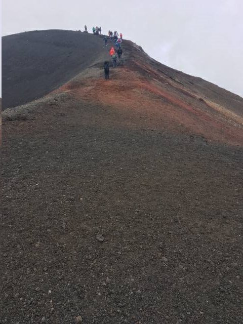
Above: TIMDT and cronies. Mt. Etna, Sicily. 29 May 2017.
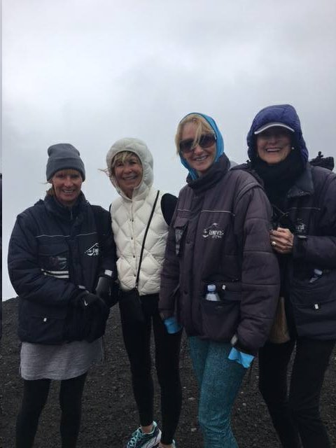
Above: TIMDT's cronies. Mt. Etna, Sicily. 29 May 2017.
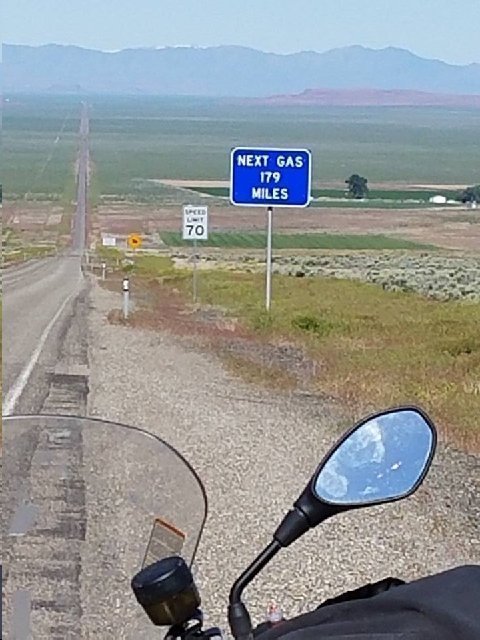
Above; NV SR 140. NW bound. 29 May 2017.
Gassed up 10 miles ago. No gas for next 180 miles, Lake View, OR.
THE Chamber guys who call US 50 through NV "the loneliest road in America," are wrong.
OR/NV SR 140 between US 95 and Lake View, OR is lonelier.
F800 GS has a 4.3 gallon tank. At 70 MPH, all other things being equal, elevation, no head wind etc. I'll get about 42 mpg. Therefore, I should be able to get to Lake View, but, with little fuel to spare. I am carrying extra fuel in the pannier, so the fuel experience won't worry me that much.
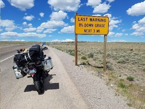
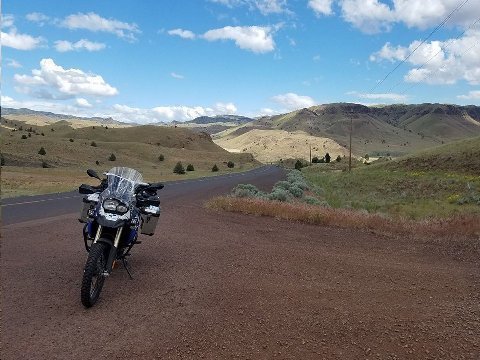
Above: Westbound. OR SR 140, 10 miles NE of NV state line.
What a difference a year makes. Last year at this time, when I had reached this sign, I had been riding (same bike, BMW F800 GS) through blizzard for the previous ten miles. For the previous five miles, wet snow was accumulating on the highway.
Last year, I was exultant when, barely, through a helmet visor covered with sleet, I saw this sign. There was at that point a two inch snow accumulation on the road. I knew I had reached Doherty Rim where there would be a steep decent and the snow would turn to rain giving rise to a safer riding surface.
Doherty Rim is one of America's great topographical features that nobody knows about. See bike image looking down rim highway.
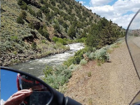
Above: Deep Creek, Adel, OR. OR SR 140 westbound. 29 May 2017.
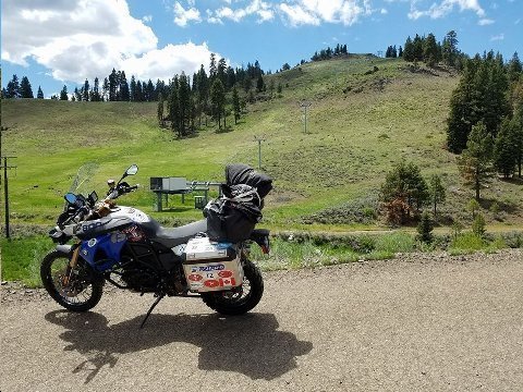
Above: Warner Canyon Ski Area. OR SR 140, 15 miles east of Lake View, OR. 29 May 2017.
Ma and Pa ski resort 10 miles NE of Lake View, OR.
I challenge Guzzi and Stockli to do Ma and Pa ski resort trip with me next year, including here, only 575 miles away from Park City.
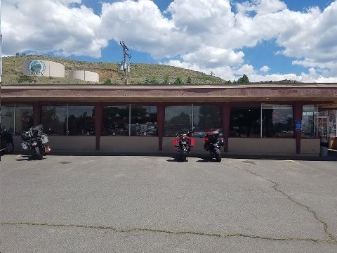
Above: Jerry's Restaurant. Lake View, OR. 29 May 2017.
190 miles on a tank of 4 gallons. 25 miles into yellow warning light. Average speed: 70 mph.
Always stop at Jerry's.
Lots of deplorables and clingers here ie. working class people who have jobs and play by the rules.
Was a periodic eater at Jerry's in Price, UT, and Globe, AZ, when I passed through, motorcycling, those places.
Cobb Salad.
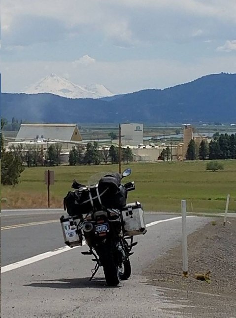
Above: It hasta to be Shasta. 29 May 2017.
OR SR 66. 10 miles west of Klamath Falls. — at Keno Store.
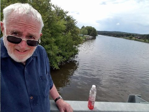
Above: Bishop and Klamath River. OR SR 66. Keno, OR. 29 May 2017.
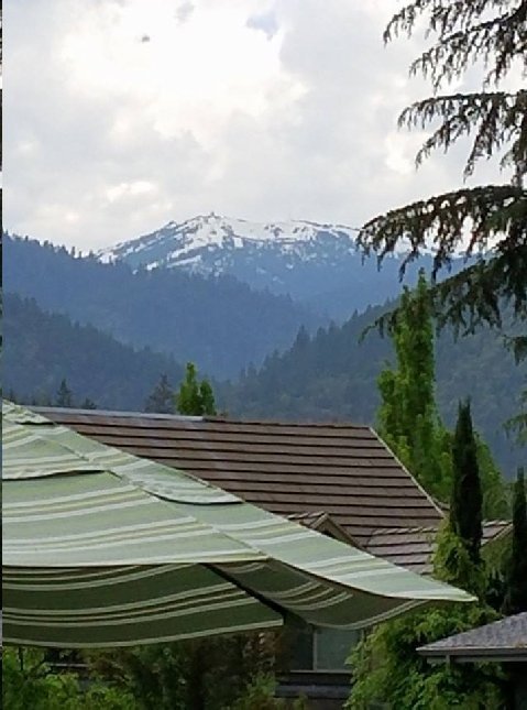
Above: Mt. Ashland. Ashland, OR. 29 May 2017.
To be included on Ma and Pa ski trip if it comes off.
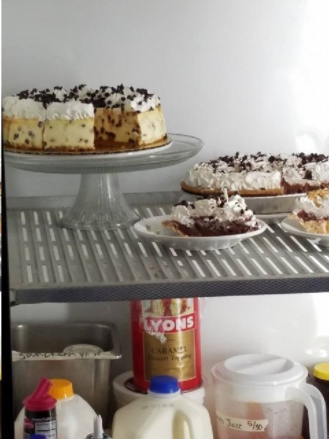
Above: Desserts. Oak Tree Inn. Ashland, OR. 01 June 2017.
What I didn't have for breakfast, but these desserts are what I'm talkin' 'bout! True, deplorable and clinger desserts.
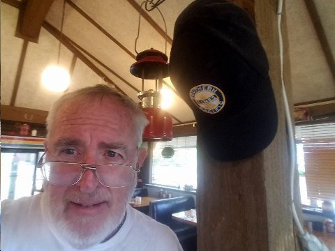
Above: Bishop at Oak Tree Inn. 01 June 2017. Ashland, OR.
Bishop poses with Bob Peterson's Southern Pacific Railway cap, hung in place of honor at Oak Tree Restaurant, Ashland, OR. Uber Clinger Bob died at age 92 two years ago.
Over the course of 15 years of coming to Ashland I'd divide my breakfasts between froo froo Brothers and clinger Oak Tree.
At Oak Tree I looked forward to joining Bob at the bar. Apart from a stint overseas as an army engineer during WWII, Bob Peterson lived all of his life in Ashland, "workin' on the railroad."
Bob Peterson. Obscure life. Played by the rules. Served his country. Scorned and ignored by American elites.
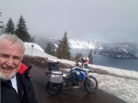
Above: Bishop and F800GS at Crater Lake National Park. OR. 01 June 2017. My routing on this fairly long, back roads riding day, diagonally northeast across the state of Oregon:
Ashland
Dead Indian Road to OR SR 140
County Road to Fort Klamath
OR SR 62 to Crater Lake National Park
OR SR 230 to OR SR 138
OR SR 138 to US 97
US 97 to OR SR 218
The remainder of the route to Walla Walla, WA is described elsewhere in this note.
About 500 miles total back road riding today. Not iron butt, but, getting up there for this old geezer. My longest day ride was ten or so years ago: Monterey to Park City; 900 miles.
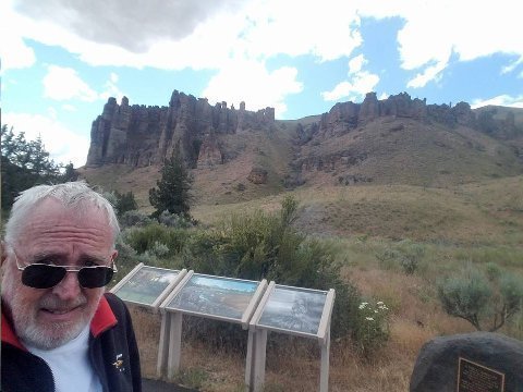
Above: Bishop Fossil National Monument, Clarno Unit. OR SR 218.
The park is known for its well-preserved layers of fossil plants and mammals that lived in the region between the late Eocene, about 45 million years ago, and the late Miocene, about 5 million years ago. The monument consists of three geographically separate units: Sheep Rock, Painted Hills, and Clarno.
Few people out here. Very obscure location. Chatted with one fifty something couple who were returning from a hike as I arrived. They were from Indiana. Western travel junkies, they had been to Utah frequently and knew Walla Walla, my destination today, very well.
Above: BMW F800 GS motorcycle. OR SR 218.
OR SR 218. Great road. Blissfully obscure. Few travelers on this road. I was thrilled to be riding this endlessly curvy road and seeing this new area. Curves and meandering went on for 90 virtually traffic free miles.
I gassed up in Madras, OR. I left US 97 20 or so miles north of Madras, OR taking OR SR 218 East. Image captures what much of the terrain was like. Road meandered over hillocks and down into arroyos. I took a break at Fossil, and fueled up at a ma and pa, the only gas between US 97 and Condon. From Condon I rode OR SR 206 to Heppner. From Heppner I took OR 74 to join US 395, south of Pendleton. At Pendleton I joined OR SR 11 for a straight shot into Walla Walla.
Towns out here... Fossil, Condon and Heppner appear as if out of the past. There seem to be no modern reference points. The general store in Fossil was made of stone and was over 100 years old. The gas station was a ma and pa with two old, battered up pumps, one for diesel and the other for 87 octane.
These towns would be good for filming a movie set in 1930's small town America.
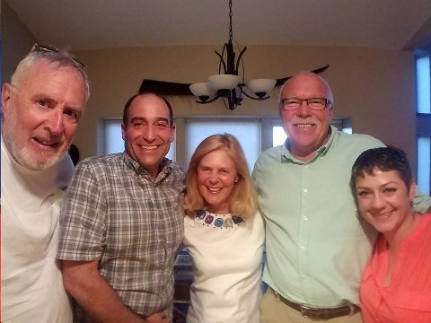
Above: Bish, Earp, Dagny, John Galt, and Mother Goose. Touchet, WA. 01 June 2017.
Bish arrives Touchet end of 500 mile, back roads, 11 hour riding day. New towns. Fossil, Pilot Rock and Happner.
Black Cod for dinner at Galts'.... See More — in Touchet, Washington.
I joined Earp and Galt on a motorcycle ride to Alaska a year ago.
Galts wonderful hosts. A big thank-you.
Addendum:
"Honor is a mere scutcheon, and I'll none of it"
One if my favorite Falstaff lines.
F16,
Park City, UT
Et tu, Brutae?
I agree, great play.
And because he was ambitious, I slew him.
F16,
Park City, UT
“There is a tide in the affairs of men. Which, taken at the flood, leads on to fortune” Act IV, Scene Three. Julius Caesar. Spoken by Marcus Brutus.
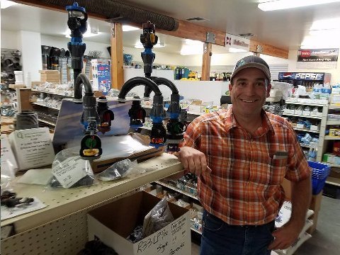
Above: Earp poses in business he manages. Dunning Irrigation. Lowdon, WA. 02 June 2017.
Won't quote the billings... but, lets just say Dunning, privately held, is not a small business. Markets irrigation throughout eastern Washington and northeastern Oregon.
Early this AM, Dagny and I went out for breakfast at The Maple Counter Café in Walla Walla. We shared an omelet. Galt had gotten up early to go take a test to obtain his commercial truckers license. After, Nancy delivered me to Dunning Irrigation to find Earp, who had offered to give me an AM agricultural tour. I was thrilled to accept his invitation.
Ag is not sexy. We take our food for granted. But, these guys are smart. Ag is highly technical. I got my first inclination of that when I accompanied Monk to a bull auction in Paradox, CO a few years ago. Each of the bulls had full detailed charts on genealogy, issue, and body fat of the ancestors etc. Bull pricing was based on which bull had the most productive genes.
And so it is with all ag. The sprinklers we are looking at here have taken the PSI required to power an irrigation system down from 50 PSI to 20 PSI. Less PSI means less electrical energy to power the system ergo lower cost for the finished crop. Some engineer, probably a WSU graduate, came up with the idea.
These ag inventions which are improving the cost/benefit yields of crops remind me of a similar phenomenon in the oil industry. Petroleum engineers are the highest paid of all college graduates. Over recent year they have drastically increased the cost/benefit for production of natural gas via fracking techniques. Their efforts have led to making energy cleaner (now abundant natural gas has half the CO2 by product as does coal) and less expensive.
The innovation driven by American engineers and farmers and the benefit that it provides to society is breathtaking in its scope. The entire world will benefit from the exciting ag/oil innovations happening in America today. Be nice to engineers and farmers. They hold our destiny in their hands.
In the image, to Earp's right are sprinklers to fit on commercial farming irrigation systems. Sprinklers are designed and manufactured in nearby Walla Walla, WA by privately owned Nelson Irrigation. Nelson Irrigation has a corner on the world market for sprinkler heads for commercial irrigation systems. They are shipped around the world... and, are the principal sprinklers used on Zammatic, Valley and Reliant irrigation systems, all manufactured in Nebraska.
Yes... we, as a culture, know a lot about Kathy Griffin, who trashes our culture, but, we know little about the engineers at Nelson Irrigation who enable us to have an abundance of food at affordable prices. Better parenting and better education is required to right our broken culture... to extol the achievers (engineers and farmers( and to scorn the destroyers, before it is too late.
Earp, in addition to managing the irrigation business also designs irrigation systems. He has his own 600 acre farm, a BMW R1150, GS and a half share in a Piper Cub airplane, which he flies.
Earp is a motorcycle riding friend that I met through John Galt. The three of us and another friend, Larry, rode to Alaska and back last year.
Earp has a wonderful family, wife and two high achieving daughters: "gals that know how to do stuff." His oldest high school senior daughter, who keeps pigs and plays the trumpet, will get a full ride student at WSU in Pullman if she wants to go there. Not interested in boys for now... interested in her studies and being excellent at all she does.
Boy... what a difference good parenting makes!
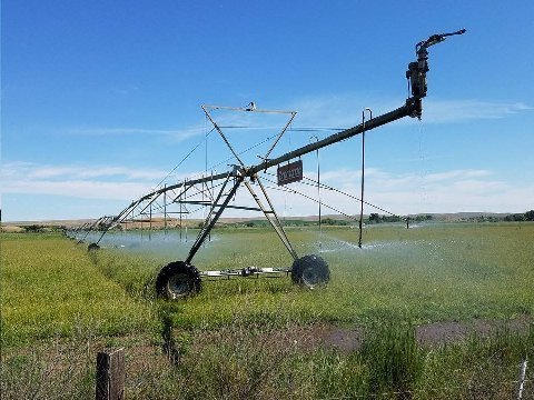
Above: Zimmatic irrigation system. Touchet, WA. 02 June 2017.
The Zimmatic system, manufactured in Nebraska, sports Nelson Irrigation sprinklers designed and made in Walla Walla, Washington.
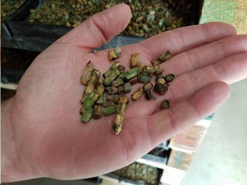

Above: Images showing process for production of alfalfa seed, a main product of Walla Walla Valley. 02 June 2017.
Alfalfa seed is pollinated by small leaf cutter bees.
1. Leaf cutter bee cell. Each cell created by bee: leaf, egg, pollen, leaf, egg, pollen, repeat.
2. Boxes of leaf cutter bee cells in controlled temperature room. Bees will hatch in time to pollinate alfalfa flower. 3 month life span.
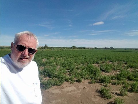
3. Bishop at alfalfa seed field.
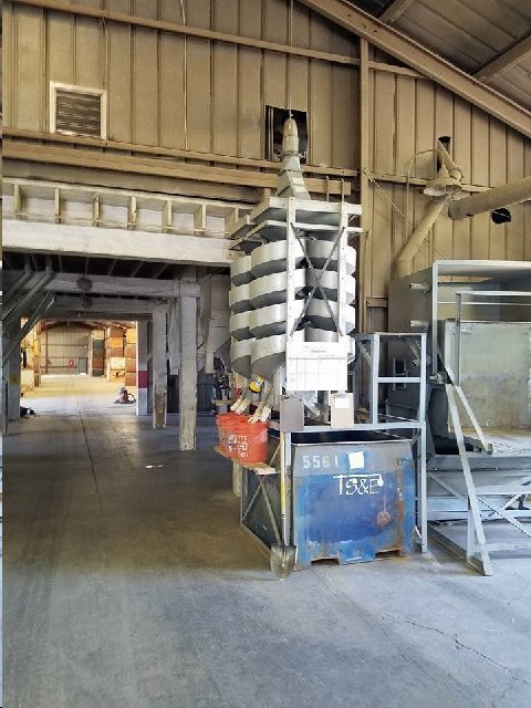
4. Final step alfalfa seed cleaning. Sorter.
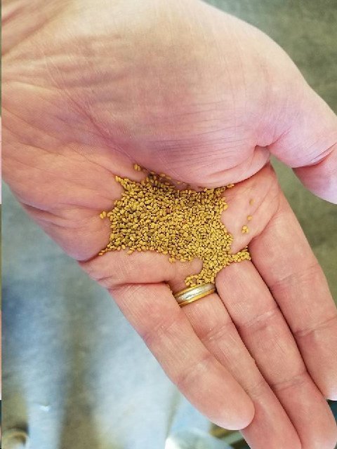
5. Final product. Alfalfa seed shipped around the world. This batch to Saudi Arabia.
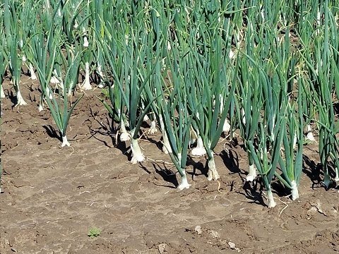
Above: Walla Walla sweet onions. Lowden, WA. 02 June 2017.
Production of Walla Walla sweet onions is highly labor intensive. They must be both planted and harvested by hand.
Walla Walla sweet onions are trademarked. The name can only be used for production from Walla Walla valley.
Similar to Vidalia onions in Georgia, also trademarked.
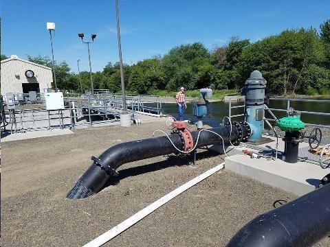
Above: Bonneville pumping and diversion station on Walla Walla River. 02 June 2017. Lowden, WA.
Earp in distance. Five irrigation canals emanate from this point. Fish weir let's salmon through.
Water is everything.
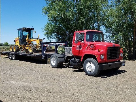
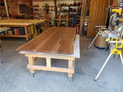
Above: Four phases of John Galt. Touchet, WA. 02 June 2017
1. Grading services.
2. Crafting custom walnut tables.
3. Personal airstrip and plane (Piper) garage.
4. 92 BMW PD motorcycle (No image).
Bishop, who can do little, in awe of guys like Galt, who know how to do stuff. Being a motorcycle poseur gave Bishop limited entrée into inner sanctum of guys who know how to do stuff. Bishop bluffed his way into the group. When the mud hits the fan (and it will), the "Galts" will reign supreme. Fascist, snowflake, and progressive narratives will crumble. Eventually, reality bites.
Addendum:
Looks like you’re heading into some weather—be careful out there big guy!
Phil, Park City, UT
Thanks for the head up!
Lucky you 😎
Brand, Ventura, CA
My best regards to Aunt Joyce.
Montage, Marina del Rey, CA
Thank you again- Taormina is lovely- we first went there in 1965 and then in 2016! Nice to see the pictures.
Love Saker, Mumbai, India
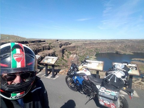
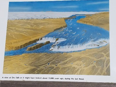
Above: (Two Images) Dry Falls. Mile marker 95, WA SR 17.
Were Dry Falls flowing today, as it did 13K years ago, at the end of the last ice age, it would be the largest falls in the world.
Second pic is artist rendition of what falls would have looked like. Note melting, receding ice in background.
There have been five ice ages in the last 500K years. Mankind needs to leave the planet before the next one comes.
What this must have looked like!
Above: Bishop selfie. Burlington, WA. 02 June 2017.
Bishop says, "hop(s) to it!"
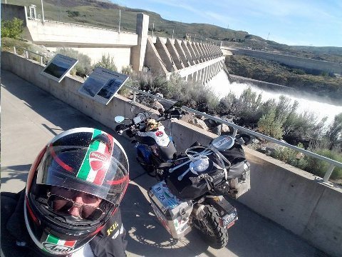
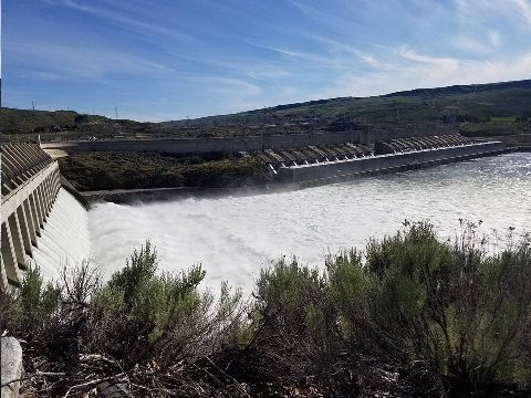
Above: Chief Joseph Dam. WA SR 17. 02 June 2017
2nd largest power production US dam.
Powers enough for all Seattle.
L shape allows for 27 turbines.
Spillway allows flow of excess water as turbines are at full capacity.
Unusual water flow reflecting above average 2016/17 snowfall in western US and Canada.
Addendum:
Hi Steve
Interesting blog.
Whenever you plan a trip to India, I would recommend you coincide with a cattle fair. The one in Nagaur in Rajasthan about 3 hours drive from Jodhpur would be a good experience. These fairs have been happening for centuries and people bring their bulls, cows, camels, horses to trade. In some cases the old system of barter is also taking place. One of our guides from Rajasthan is very well versed with aspects of the domestic cattle trading as well as irrigation systems, agriculture and crops that are grown in this dry and desert region of Western India. It would be very interesting for you.
Cheers.
Mohan,
New Delhi, India
Thanks. You've whetted my appetite!
I took a four mile walk through Omak, WA, before starting out for Kamloops, British Columbia, Canada. Two or three passers by were wearing, "Make America Great" caps.
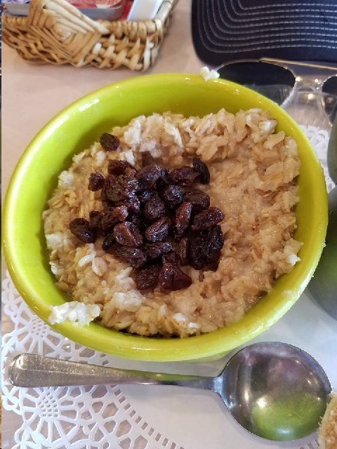
Above: Oat meal. Magoo's. Omak, WA. 03 June 2017.
Eatin' good in deplorables' neighborhood.
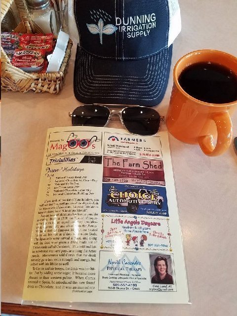
Above: At Magoo's. Omak, WA. 03 June 2017.
Bishop's morning montage. Small town breakfast experience.
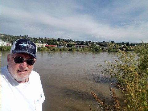
Above: Bishop at Okanogan River. Omak, WA. 03 June 2013.
Hyper swollen river just short of flood. Beaucoup snow this year in US and Canadian Rockies.
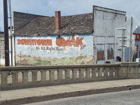
Above: Building in Omak, WA. 03 June 2017.
"It's All Right Here!"
It is?
Entire town looks like it needs a new roof!
Working people here were left behind as the bi coastal, investor elite rode their central bank fueled stock bubble to Potemkin prosperity.
This is Trump's political genius. He looked back at those who struggled where the self centered and greedy elites looked only "forward," scorning or ignoring those left behind.
The bitter clingers and the deplorables were down... but, not out.
Revenge is its own reward?
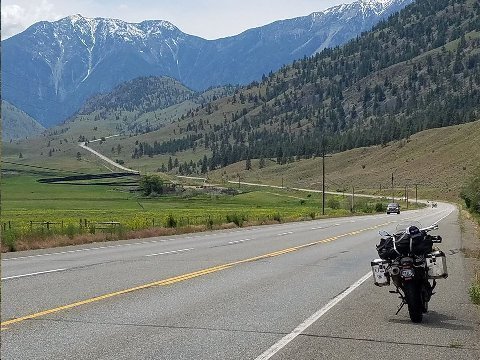
Above: Route 3. BC. 03 June 2017.
Looking west direction Vancouver. BMW R800GS motorcycle.
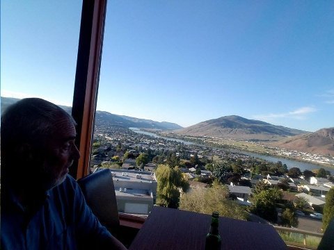
Above: Nandi's Restaurant. Kamloops, BC. 03 June 2017.
Wonderful view of the Thompson River valley.
Kingfisher.
Beef samosas.
Muttar Panneer curry.
Addendum:
Steve
My daughter Dana, whom you know, wishes she could have organized a behind the scenes tour for you at the dam as that is one that is in her domain. She is still an engineering manager with Army Corps of Engineers, with particular responsibility for several dams and navigable waterways in WA and a little beyond.
Do keep in mind that you know a dam(n) engineer if you have another similar opportunity. She has arranged for me to be led into the very bowels of some locks and dams out there and it's quite a treat. More than a little frightening to see how very old the infrastructure is.
Shock,
Scranton, PA
Next time. Woulda been great to have a tour this time through. Magnificent dam is Chief Joseph.
Thanks Steve. I'm glad I want be around to make preparations to leave!
Saker,
Mumbai, India
Move quickly!
Great shots Steve !
Brand,
Ventura, CA
Considering the source of this compliment, I'm honored.
Hi Steve
Interesting blog.
Whenever you plan a trip to India, I would recommend you coincide with a cattle fair. The one in Nagaur in Rajasthan about 3 hours drive from Jodhpur would be a good experience. These fairs have been happening for centuries and people bring their bulls, cows, camels, horses to trade. In some cases the old system of barter is also taking place. One of our guides from Rajasthan is very well versed with aspects of the domestic cattle trading as well as irrigation systems, agriculture and crops that are grown in this dry and desert region of Western India. It would be very interesting for you.
Cheers.
Mohan
Interested.
Steve,
To return to an earlier e-mail, did you ask the “sprinkler man” in Washington State why people get involved in agriculture (from the farm to the restaurant/grocery store) when the work is at the mercy of the weather, the labor is backbreaking and the financial rewards aren’t that high?
I’m curious,
Ahnrhee, Larkspur, CA
No. but, this guy is third generation there. Between outright farming, Irrigation systems design and sales, and ownership in various processing businesses i.e. alfalfa seed, he does well enough to own a plane... has time enough to go on motorcycle adventure rides... and contributes with his wife to have an outstanding family.
Steve,
Looks like your trip is quite amazing, so is this video. Wonder who funded such an incredible study?
What Happens When Two Monkeys are Paid Unequally for the Same Work?
PGA, Greensboro, NC
Kamloops, BC to Prince George, BC. 325 miles.
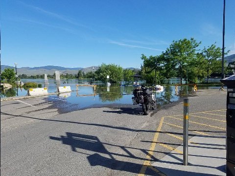
Above: F800 GS parked at Thompson River overflow. Kamloops, BC. 04 June 2017.
The Thompson River is a major tributary of the Fraser River. Both rivers originate on the western slopes of the Canadian Rocky Mountains.
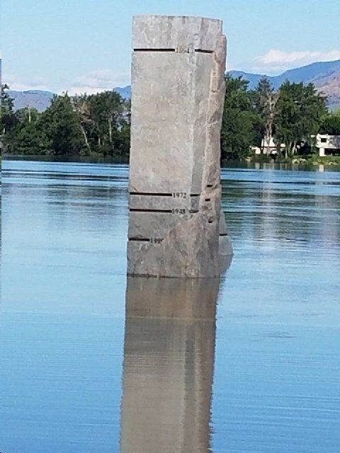
Above: Pillar showing high water levels. Thompson River, Kamloops, BC. 04 June 2017.
High water shown on pillar occurred during 1884.
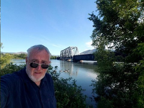
Above: Bishop and Thompson River railroad bridge. Kamloops, BC 04 2017.
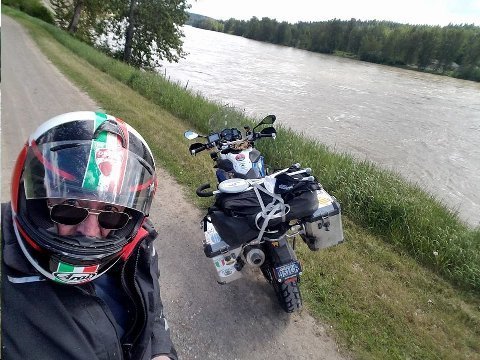
Above: Bishop and bike (BMW F800GS) at swollen Fraser river. Somewhere on route. 04 June 2017.
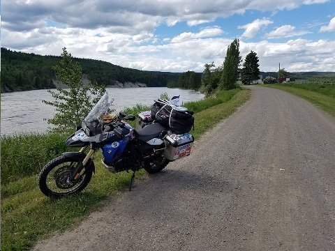
Above: F800GS and Fraser River. 04 June 2017.
Reverse direction of the previous image.
Above: Facebook check in for Thanh Vu Restaurant. Prince George, BC. 04 June 2017.
This restaurant was adjacent to my hotel. Four Points, Sheraton, Prince George, BC.
The food was surprisingly good.
Chicken and vegetables in peanut sauce.
Why "surprisingly," I'm not sure. I wasn't thinking that much fine cuisine happened above the 50th parallel. Was wrong.
Last night at Nandi's (Indian) in Kamloops, BC was also terrific.
High food standard TIMDT would have liked them both. Too bad she doesn't like sitting behind me on the bike and doing four hundred motorcycle miles every day.
440 miles.
Prince George, BC to Stewart BC/Hyder AK.
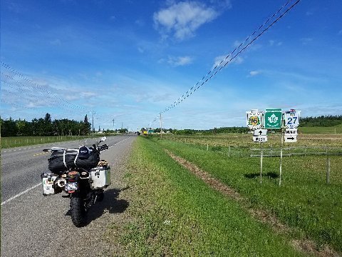
Above: BMW F800 GS Motorcycle. BC route 16. 05 June 2017.
West bound.
BC 16. The Yellowhead Highway. Also an arm of the Trans Canada highway as it starts on the Pacific coast at Prince Rupert.
BC 27 is a turnoff running north, to Fort St. James, a former fur tradimg post on the vast lake Stuart. Elk, Joe, and Mwah (sic) rode the 40 miles, up there and back, ten years ago.
RIDING REFLECTIONS
1. Don Imus requested "my five favorite songs."
I Can't Help Falling in Love With You - Elvis
Convoy - C. W. McCall
Take it Easy- Eagles
Die Moldau - Smetana
Organ Symphony- Saint-Saens
2. Riding "kilometers" always seems shorter than riding miles. When I see a kilometer distance sign, my brain instinctively thinks it's a "mileage" sign. When I make the calculation from "klicks" to miles (1km = 5/8 mile), I'm pleased that the distance remaining is much shorter than I first "thought."
3. I love the highway names. Today, The Yellowhead Highway. Highway names give rise to a special, iconic feel about the ride/journey.. Same with trains: Orient Express, Delhi Mail, Rajdhani Express, The Ghan, The Trans Siberian Express.
4. Crack sealing technique on Canadian highways is far superior to the US method. In Canada, after the sealant is put into the crack, sand is generously layered on top of the new seal. The resultant seal develops a similar adhesive quality to that of the road surface. US crack seals, with no adhesive applied, are slick and squishy, particularly at high temperatures.
5. Fuel. On this ride I'm carrying 5 liters of extra fuel in my panniers. Beaucoup peace of mind when there are many ride segments up here with 150 miles plus distance between fuel stops. The F800GS, all other things being equal (speeds not to exceed 70 mph and no head wind) has a 180 to 200 mile range. Extra fuel means greater flexibility.
6. Ear plugs. I put a taller, after market wind screen on the F800 GS. Notwithstanding, cavitation makes for nasty wind noise in the helmet. I started using ear plugs. What an invention! Quiet and smooth riding experience. Because of years of customary riding sans using ear plugs, I always forget to insert the plugs when I start riding. Once I start riding, I sense the noise. So, I stop at the first safe place and insert the plugs. Goal for this trip is to regularly insert ear plugs when I first start out. Don't need ear plugs when riding the Duc. Better fairing arrangement there.
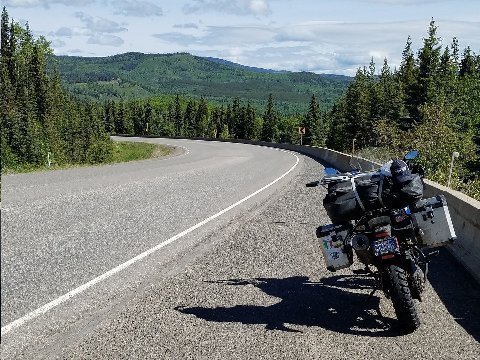
Above: BMw F800 GS motorcycle. BC 16 westbound.
Highway 16. Yellowhead Highway, part of the Trans Canada highway system. I am riding the road today between Prince George and Kitwana. There, I take BC 37, the Cassier Highway, north, as far as BC 37. I'll turn east on BC 37A to reach Stewart, BC and Hyder, AK, the end of today's ride.
Not an atypical view. Trees, trees, trees, and underneath the canopy, bears, bears, bears.
10 years ago, while motorcycle riding on The Yellowhead Highway, Joe, Elk, and Mwah (sic) saw considerable forest ruin from pine beetle infestation. Not so today. All green....everywhere... green, GREEN!
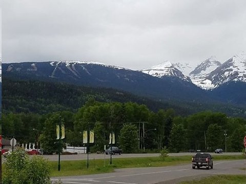
Above: Smithers ski area. Smithers, BC. 05 June 2017.
Hudson's Bay Mountain to the right.
So far away. Who comes here? Locals only?
Guzzy, I'll give you $100 if you come ski here.
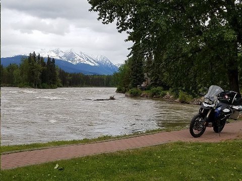
Above: Bulkley River. Telkwa, BC. 05 June 2017.
Everywhere, beaucoup water. Nearly overflowing rivers never heard of, flowing to who knows where. Reroute flow to Las Vegas, Phoenix, and San Diego. — at Telkwa, Bc.
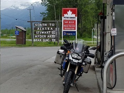
Above: Bike at Kitwanga Junction. BC. 05 June 2017.
North to Alaska.
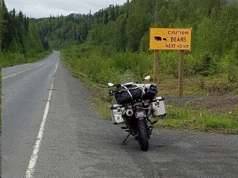
Above: Bear warning sign. BC 37. 05 June 2017.
85 miles up the Cassier Highway, from the turnoff from the Yellowhead Highway, Kitwanga, BC, I saw this sign. 5 miles before the sign, I saw my first bear, a full sized black bear, foraging below the road shoulder on my side of the road. Having been admonished last year by John Galt about my foolish stop for a photo op of a brown bear cub, I continued on this time sans stopping.
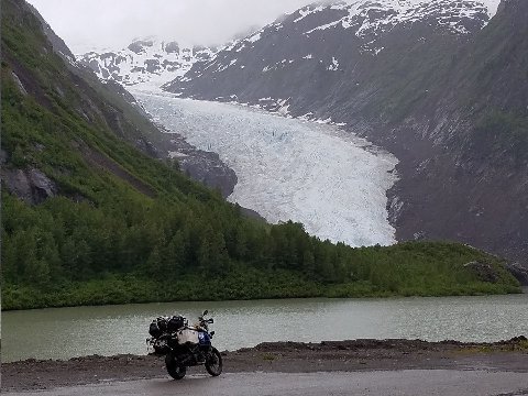
Above: Bear Glacier. BC 37A. 05 June 2017.
The eighteen mile descent down BC 37A, from 1300 feet elevation at Bear Glacier, to sea level, through a glacially carved canyon, is a marvel. Plenty of curves, the raging Bear River on the right, and snow patched, glacially carved gum drop mountains , enshrouded in mists, on the left. Unworldly motorcycle riding sensation. — in Stewart, British Columbia.
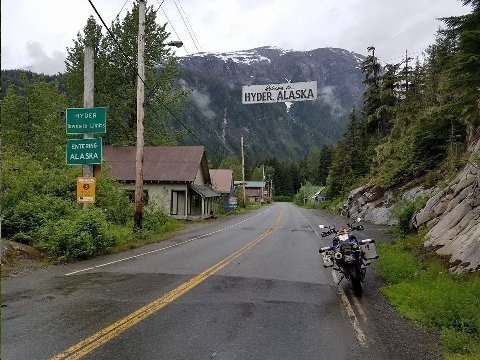
Above: Hyder, AK. 05 June 2017.
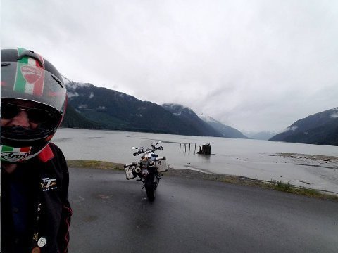
Above: Portland Canal. Hyder, AK. 05 June 2017.
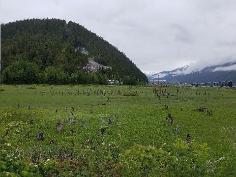
Above: Pylon remnants of Portland City. Hyder, AK. 05 June 2017.
Bishop back home in US...uh...wait..
How many places can you legally walk in to the US with no immigration control point? Canada, par contre, has a full immigration check point for individuals leaving Hyder and entering Canada.
Portland Canal leads into Hyder from North Pacific (entrance is very near Prince Rupert, BC), 90 miles distant. Think Norwegian fijord. The canal forms the border between southern Alaska and British Columbia. 5 miles further out the Portland Canal from here is Misty Fjords National Monument, visited only by air or sea.
Old pylons supported Portland City (former name of Hyder), gold mining days pre WWI. Portland City shut down in 1935 when FDR pegged price of gold at $35.00 per oz.
Ketchikan is only 40 miles away by air from Hyder.
Hyder today is more or less a ghost town. A couple of gift shop's, a seafood restaurant in an old school bus. Sealaska Inn, where Joe, Elk, and Mwah (sic) stayed 10 years ago looks more beleaguered now than it did then.
I'm staying at the King Edward Hotel in adjacent Stewart, BC.
HYDER VERSUS STEWART
Ten or more years ago, shortly after my first motorcycle ride to Hyder, a piece was published in the Wall Street Journal which used Hyder/Stewart as a metaphor for how Americans and Canadians, generally, are different from one another.
Hyder: Rough and tumble. Brash. Noisy. Crazy. Entrepreneurial. Free wheeling. Couldn't care less, devil take the hindmost, rampant individualism.
Stewart: Sedate, orderly, quiet, cooperative, docile, obedient.
Authors conflated the Hyder/Stewart dynamic to describe the difference between Americans and Canadians generally.
The chaotic, boisterous, independent, American paradigm, as compared to the "boring" Canadian model, was seen by the authors as a seed bed for energy and creativity. Canada, par contre, was seen as a docile, adaptive and dependent place.
Authors said it started with the American revolution. Not all American colonists wanted to buck George V. So, rather than fight in the revolutionary war, the "royalists" head north and continued in their loyalty to the king i.e. go along get along. And so it is, that docile Canadians pursue their boring, listless lives, even today... or so say the authors.
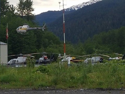
Above: Helicopters at Stewart, BC. 06 January 2017.
This image about 7:00 AM captured during an early morning walk.
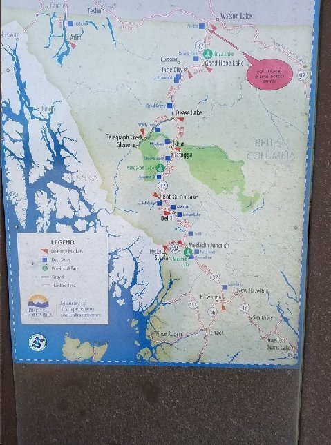
Above: Map of Cassier Highway. 06 June 2017.
This map shows my route today. 400 miles. From Stewart, BC/Hyder, AK northbound to Watson Lake, YT.
This highway is the "alternate way" to drive north to Alaska. The Cassier Highway intersects with the Alaska Highway in Watson Lake, YT. The Alaska Highway starts in Dawson Creek, BC, very near the Alberta border. I took that route last year.
I like this map (seen on a story board at a road side stop) because of how well it shows the relationship of the Cassiar Highway to the lower part of Alaska. Besides the access from Canada to Alaska at Hyder, there is no way to drive into any other part of Alaska, other than to reach the Alaska Highway 400 miles north of Hyder/Stewart via the Cassiar.
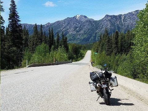
Above: BC 37 Cassiar Highway. Northbound. 06 June 2017.
This and the following shot are representative of thousands of like vistas along the Cassiar Highway. Patagonia redux.
The final (and only) gas stop before Watson Lake is Dease Lake. Between Dease Lake and Watson Lake is 150 miles.
So, I stopped for gas and a snack at Dease Lake. There I chatted with two mid 30's motorcyclists from Ontario. One of them was riding one of the new Honda Africa Twins. The rider of the Africa Twin said he bought the bike in Soo Saint Marie, ON when his other bike broke down. He and his friend lost a week on their trip because of the bike change. They had hoped to reach Fairbanks, AK. Because of the lost week, they had to turn south from the Alaska Highway to the Cassiar Highway, where I met them today, and head back home. Their destination today was Stewart/Hyder where I had spent the previous night. Sheepishly, they said they wanted to say they had reached Alaska. Not sheepishly! It was a big ride they had accomplished already. And, Hyder is in Alaska. My first ride to "Alaska" was on a ride to Hyder ten years ago.
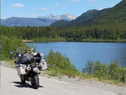
Above: BC 37 Cassiar Highway. Southbound. 06 June 2017.
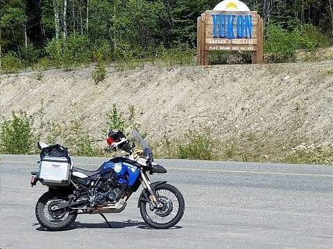
Above BMW F800GS motorcycle at the border between British Columbia and Yukon Territory. BC 37 Cassiar Highway. 06 June 2017.
This sign also marks the near end of the Cassier Highway. The Alaska Highway is only a couple of miles further down the route.
'OK' animal sightings along the road today. Four bears in three different sightings. One moose.
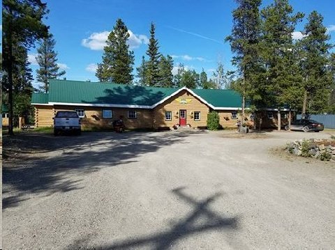
Above: Air Force Lodge. Watson Lake, YT. 06 June 2017.
The structure is a restoration of one of the barracks used by US Air Force Pilots in WWII.
A German (now Canadian) couple owned and managed the Air Force Lodge. Clean... but, you stay in the style of the flyers of yore eg. common bathrooms and showers.
It was a bit more work to get to the bathroom at night... but, overall, I liked staying at the Air Force Lodge. A bit different. Interesting owners making their way in life.
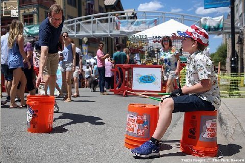
Above: Bud doing bucket drums. Park Silly Market. 06 June 2017.
Addendum:
I am docked at Devil's Island and plan to go ashore and walk around, Saw the Boi Bumba show in Parintins. It was great. Costumes are 2nd only to Carnival. We still have Barbados and San Juan before two days at sea and back to Fla.
Bridge,
Palm Beach, FL
Want to hear more about your Devils Island visit.
Steve, one of my good friends in Stanfordville where we spend weekends is G... C..., who has a wanderlust gene like yours. In fact he is leaving in the middle of next week on his 1200 for a solo road trip like yours to the Prince Edward Islands. He was over this morning and I shared your June 5 Picto Diary with him. He loved in and asked if I would share it with him. Herewith I am sharing it with him and introducing you to each other for what I expect will be a great mutual friendship even if your paths never cross…But the might.
Park Avenue, New York, New York
Thanks for the intro. I'd like to meet up some time!
Nice job Steve thanks.
Brand,
Ventura, CA
Considering the source, a meaningful complement.
This sounds like a very cool adventure! Funny, I too prefer measuring things in km when I xc ski or when I am on my road bike. Somehow pedaling 40k seems better than 24 miles...or bumping speed from 30kph to 33kph feels more intense than going from 18 to 19mph
All the best,
The Globalist,
Park City, UT
Like minds think alike?
Extraordinary Chinese in White Horse.
David Ow (known Chinese food expert; Tomato Beef) and I will no doubt sample
it again in August. Great trip, ride safe,
Mike,
Dallas, TX
I’d add to your song list:
Ghost Riders in the Sky- Johnny Cash and others
Danny Boy- Many
Little White Cloud that Cried-Johnny Ray
Smoke Gets in Your Eyes-Nat
Little Darlin-The Diamonds
The Great Pretender-The Platters
Georgia-Willie Nelson
Somewhere Over the Rainbow-Willy K
Hallelujah-Many
Rhapsody in Blue-
Time in a Bottle-Jim Croce
Classical Gas-Mason Williams
Rocket Man- Elton John
Mrs. Robinson-Simon and Garfunkel
Imagine- The Beatles
I guess that’s over 5
'Cake,
Park City, UT
No to Elton John's stuff. I only liked one thing he ever did and that piece didn't do that well: "The Club at the End of the Street."
Also, no to "Imagine." A sinister and misleading lure to an impossible human condition.
Incredible scenery but I hope you’re not riding in these remote areas alone.
Interesting difference in the slurry seal in Canada vs. U.S. One of my greatest fears riding in the heat is really leaning into a curve but then encountering a U.S. version of slurry seal.
Captain, Park City, UT
I'm not doing any roads where there aren't at least a few other travelers.
This here’s the "Side of the River!" What’s your handle? (aka Manhattan)
Convoy Lyrics
New! Highlight lyrics to add Meanings, Special Memories, and Misheard Lyrics...
Play "Convoy"
on Amazon Music
SUBMIT CORRECTIONS CANCEL
Was the dark of the moon on the sixth of June
In a Kenworth pullin' logs
Cab-over Pete with a reefer on
And a Jimmy haulin' hogs
We is headin' for bear on I-one-oh
'Bout a mile outta Shaky Town
I says, "Pig Pen, this here's the Rubber Duck.
"And I'm about to put the hammer down."
'Cause we got a little ol' convoy
Rockin' through the night.
Yeah, we got a little ol' convoy,
Ain't she a beautiful sight?
Come on and join our convoy
Ain't nothin' gonna get in our way.
We gonna roll this truckin' convoy
'Cross the U-S-A.
Convoy!
By the time we got into Tulsa Town,
We had eighty-five trucks in all.
But they's a roadblock up on the cloverleaf,
And them bears was wall-to-wall.
Yeah, them smokies is thick as bugs on a bumper;
They even had a bear in the air!
I says, "Callin' all trucks, this here's the Duck.
"We about to go a-huntin' bear."
'Cause we got a great big convoy
Rockin' through the night.
Yeah, we got a great big convoy,
Ain't she a beautiful sight?
Come on and join our convoy
Ain't nothin' gonna get in our way.
We gonna roll this truckin' convoy
'Cross the U-S-A.
Convoy!
Well, we rolled up Interstate 44
Like a rocket sled on rails.
We tore up all of our swindle sheets,
And left 'em settin' on the scales.
By the time we hit that Chi-town,
Them bears was a-gettin' smart:
They'd brought up some reinforcements
From the Illinois National Guard.
There's armored cars, and tanks, and jeeps,
And rigs of ev'ry size.
Yeah, them chicken coops was full'a bears
And choppers filled the skies.
Well, we shot the line and we went for broke
With a thousand screamin' trucks
An' eleven long-haired Friends a' Jesus
In a chartreuse micra-bus.
Well, we laid a strip for the Jersey shore
Prepared to cross the line
I could see the bridge was lined with bears
But I didn't have a dog-goned dime.
I says, "Pig Pen, this here's the Rubber Duck.
"We just ain't a-gonna pay no toll."
So we crashed the gate doing ninety-eight
I says "Let them truckers roll, 10-4."
'Cause we got a mighty convoy
Rockin' through the night.
Yeah, we got a mighty convoy,
Ain't she a beautiful sight?
Come on and join our convoy
Ain't nothin' gonna get in our way.
We gonna roll this truckin' convoy
'Cross the U-S-A.
Convoy! Convoy! Convoy! Convoy!
Songwriters
Read more: C.W. McCall - Convoy Lyrics | MetroLyrics =
Manhattan, Park City, UT
Boy I love that song. It should be an anthem for the deplorables and the bitter clingers.
Today's ride (07 June 2017) is from Watson Lake, YT to Whitehorse, YT. Along the Alaska Highway. 275 miles. Short ride. Time to contemplate sites along the way and to spend some time exploring Whitehorse and environs.
Last year, plying this route, we rode from Liard Hot Springs, BC, on the Alaska Highway, to Whitehorse, 404 miles.
Above: Kathy's Restaurant. Watson Lake, YT. 07 June 2017.
My typical breakfast is two scrambled eggs and a bowl of oatmeal.
Above: Signpost Forest. Watson Lake, YT. 07 June 2017.
Probably the largest public display of stolen property in the world. There are 80K location signs here. The practice was started during WWII by the construction workers building the Alaska Highway.
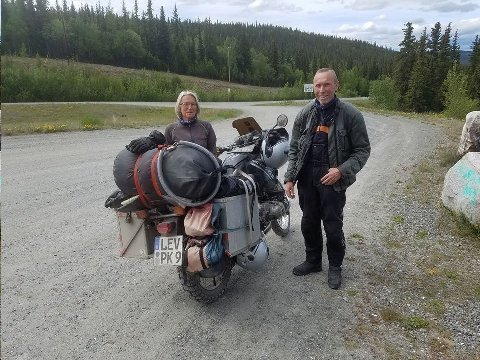
Above: Herbert and Gelsa, Cologne, Germany. Teslin, YT. 07 June 2017.
These true motorcycle adventurers are riding a '95 BMW Paris Dakar (PD) motorcycle. Among motorcycle aficionados, the PD has iconic status.
Herbert and Gelsa started their trip in Nova Scotia. They are headed to Dawson to attend the "Dust to Dawson Motorcycle Rally," on 15/16 June 2017. They plan on ending this phase of their trip in Seattle, three weeks from now.
The starter broke on their PD. They have to roll the bike to get it going. The image shows them parked on a hill above Teslin, YT so as to use gravity to get the bike moving to pop the clutch for an engine start. They have ordered a replacement starter to be shipped from Denver to Dawson.
Germans are, hands down, the world's uber adventure travelers.
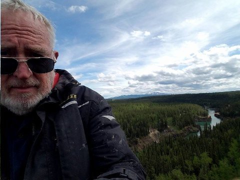
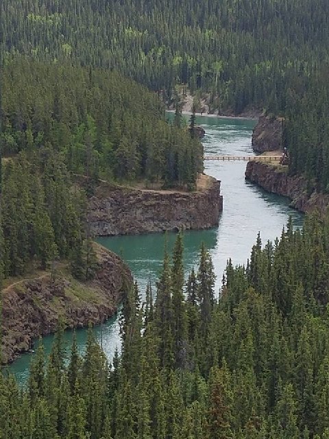
Above: Two images of Miles Canyon and Yukon River. Whitehorse, YT. 07 June 2017.
The bridge (walking only) is only one of a half dozen bridges or so that span the 2000 mile length of the Yukon River.
A few years ago, while riding a Kawasaki KLR motorcycle up to Prudhoe Bay, I crossed the Yukon two hundred miles north of Fairbanks, on a large span which accommodated the big "ice road" trucks plying the Dalton Highway to Dead Horse (Prudhoe Bay).
I walked across the Miles Canyon bridge, seen in the image, while visiting Whitehorse last year at about this time.
The river seen here is backed up by a dam, constructed in 1959, two miles down stream. So the flow here is placid and easy flowing. The reservoir just above the dam is called Schwatka Lake.
Before construction of the dam, Miles Canyon had class five rapids.
In Klondike gold rush days, 1898, many miners died trying to navigate down the White Horse rapids on their way to Dawson City and the Klondike River gold. After too many casualties in the rapids, a portage service was set up on each side of the river.
So much water up here! Nobody uses it. Pipeline to San Diego?
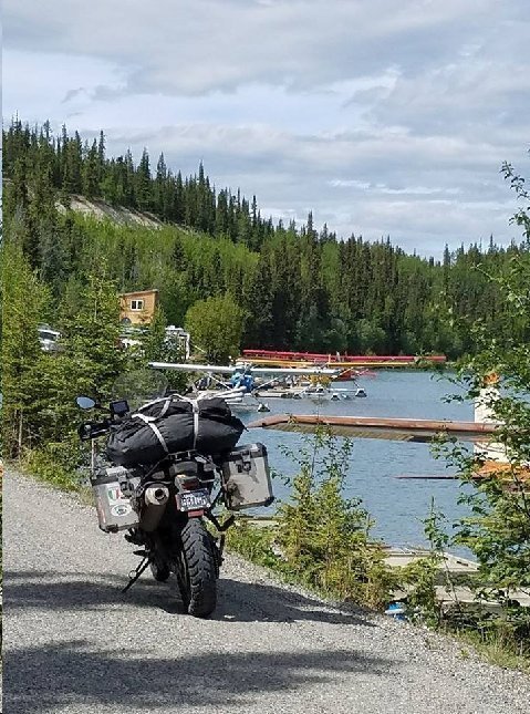
Above: F800GS motorcycle and float planes in Schwatka Lake. Whitehorse, YT. 07 June 2017.
John Galt's dream. Whitehorse would seem to be a good place for Galt's Gulch in any case.
Post visiting Miles Canyon and Schwatka Lake, I checked into a Best Western Motel, walked around Whitehorse, and dined at G and P Grill (good place).
Addendum:
Steve,
The most famous event that happens in Omak, is the suicide race. This happens annually in conjunction with the Omak Stampede. They have tried to stop the event on numerous occasions because of the danger to the horses. However, because the race is on a reservation and most of the riders are native Americans the event continues. About eight riders, starting on foot run to their horses race for about one hundred yards, then go down a very steep cliff, where often the horses will stumble along with riders. At the bottom of the cliff they enter a river, ford it for about fifty yards, race up the other side Nd race into the show grounds. Very exciting and winner has serious bragging rights for the year. The stampede , run by the native Americans is a spectacular event that goes on for several days. Worth the effort.
Bill,
Tacoma, WA
I'd love to see this sometime. I've been motorcycling in and around Omak for years, but, have missed this.
Devil's island is actually very pretty, you could walk the whole island in about two hours. The day we were thee it was misty so the steps up to the museum and various buildings were slippery, also muddy paths. We saw monkeys and agoutis (small brown furry creatures, rat like but without a tail.), macaws and of course it suppose to be surround by sharks (but I did not see any). There are drop offs to the sea with rocks. We saw people staying there and fishing. There are three islands in all. We went to the main one where the prison was.
Bridge,
Palm Beach FL
We're doing a Panama Canal cruise later in the year... but, we'll miss Devil's Island. Bummer.
Steve,
If you haven’t seen it, try to get your hands on today's Sunday NYT on your journey. Sports section has a great, long piece on the Isle of Man TT race.
Incredible course, incredible riders.
Tom,
Aspen, CO
Thanks Tom. I was a spectator at the TT in 2015. I rode a rented motorcycle from Bornmouth, UK to Liverpool and took a ferry over to the Isle of Man. I was able to ride the Mountain Course when it was opened to amateur riders. I'm guessing I rod at 1/3 the speed of the winning racers. However you feel about the gladiator-like aspect of the TT, it is thrilling to watch. A truly iconic sporting event.
Last thing at night is to catch up on your vision quest and drift off to my Walter Mitty world.
Peterbilt,
Salt Lake City, UT
The lack of roads north to Canada reminds me of the great difficulty traveling from Moscow east to Vladivostok. Maybe that is a ride you should try if you have not already done it.
Looks like you are having a great trip. Be safe. Look forward to seeing you when you get back.
The Monk,
Salina, UT
I've ridden through Dagestan, Chechnya, Ingushetia, and North Ossetia. Riding in Russia is very challenging. One of the only places I have ridden where there is nothing... nothing... road signs or whatever in the English language. A friend of mine attempted the Vladivostok ride, but, gave up somewhere along the route.
Dear Steve,
Does the couple that run the Air force Lodge in Watson Lake. YT, require you to remove your boots and leave them near the entry door?
The Cassiar Highway was created as a logging road (dirt) and was still mostly so when Anni and I first traveled on it in 1996 in an SUV. The province of British Columbia had decided to encourage development of that area by paving the road. During subsequent years and on various different motorcycles, the paving became more complete so it is now done. The development? … “we’ll see”; BUT as you no doubt noticed, there is now a high capacity electric transmission line strung along the road which was still under construction last year. I asked a construction flag woman which way the electricity was going to flow and her answer: south to north to service a mining facility located around the northern sector of the “Cassiar”. Maybe this is the “planned-for” development. The helicopters I saw last year were rather like a swarm of bees around the actual construction activity- installing the towers, stringing the electric cable, etc.
Anyway, thanks for re-kindling fond memories of a pretty part of the world.
Please enjoy the “Top of the World” “highway” (a dirt road) a you ride along the ridge, approximately 40 KM, where mountain peaks are receding from you in 360 degrees for the entire time- not necessarily spectacular at any one point; bit the continuation is striking- well, I think so.
A t-shirt from Chicken, AK?
Thanks for your travelogue and enjoy the ride.
Ahn Rhee, Larkspur, CA
Yep. The Same. No shoes. The place was very clean... that was the major plus. Great supplement on the Cassiar! Thanks! Looking forward to "Top of the World, (which I actually rode yesterday... but, I can't get ahead of myself... check my Facebook posts which are more current)! OK... I bot a cap not a shirt!
08 June 2017 - Today. I ride my BMW F800 GS motorcycle north along a portion of the Klondike Highway. YT 2. North from Whitehorse, YT to Dawson City. 330 miles.
The Klondike Highway starts in Skagway, AK as AK 98. At the top of the White Pass the highway enters the Yukon and becomes YT 2. The Klondike Highway terminates in Dawson City, YT. Its total length is 438 miles.
The highway roughly parallels the route taken by most of the gold seekers taking part in the Klondike gold rush of 1898. The Klondike gold rush is widely viewed to be one of history's greatest human endeavors. Two great authors told its tale: Jack London and Robert W. Service.
The portion of the highway going north from Whitehorse, YT, which I will be riding today, has beautiful views of the Yukon River. The route crosses two of the Yukon's significant tributaries: the Pelly River and the Stewart River.
Above: Bishop at Five Fingers Rapids. Yukon River. Klondike Highway. 08 June 2017.
During the gold rush days around the turn of the 20th century, steam boats would make their way up the Yukon River as far as Whitehorse. Because of the severe rapids at Miles Canyon, the boats could proceed no further.
Five Fingers Rapids, here between Whitehorse and Carmacks, posed a minor obstacle for the steam boats as they made their way up river.
The nearest of the five channels, visible in this image, is one hundred feet in width. The rapids have a two feet rise. The up stream going stern wheelers could fit in the channel, but, they'd have to winch the boats over the rise.
300 commercial steamboats worked the river during the peak period of the gold rush.
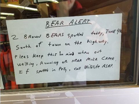
Above: Bear Alert sign in Pelly Crossing convenience store. Pelly Crossing, Klondike Highway, Yukon.
I had my run-in with a brown bear last year north of Liard Springs, BC. I'm not stopping to observe this time!
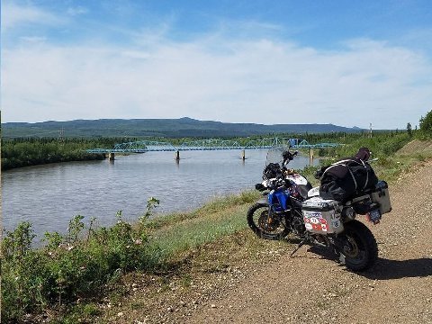
Above: Pelly Crossing. Pelly River. Klondike Highway. Yukon Territory. 08 June 2017.
The source of the Pelly lies three hundred fifty miles to the east in the McKenzie Mountains.
I marvel at the size of the Pelly... a heretofore unknown (at least to me) waterway. I guess my awe at the size of these Canadian rivers derives from my upbringing, where to me, as a boy, the spring runoff of the Provo River seemed like a big deal.
The Pelly's average discharge (700 m3 per second) is higher than the average discharge of the Colorado (640 m3 per second).
Millions living in the southwestern US are precariously dependent on the fragile Colorado, where most of the Pelly, commingled into the Yukon, flows out to sea. There is plenty of water for everyone on the earth, its just that much of it is out of reach from where the people are living.
The Yukon is the fourth largest river system in North America with a discharge of 6,400 m3 per second. The first three are the St. Lawrence, 16,800 m3 per second; the Mississippi, 16,700 m3 per second; and the Ohio, 7,900 m3 per second.
A further comparison. The Amazon: 209,000 m3 per second.
I confess to being awed by great flows of water. I teared up in '09 while riding a Royal Enfield Bullet motorcycle across the Brahmaputra River near Guahati, Assam, India.
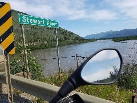
Above: Stewart River. Stewart Crossing. Klondike Highway. Yukon. 08 June 2017.
Another Yukon Tributary. Discharge 850 m3 per second. River originates 330 miles to the east in the Selwyn Mountains.
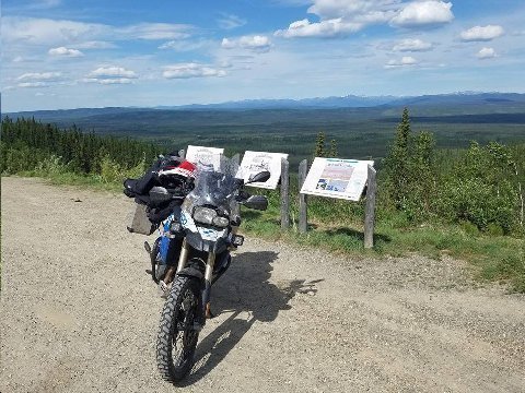
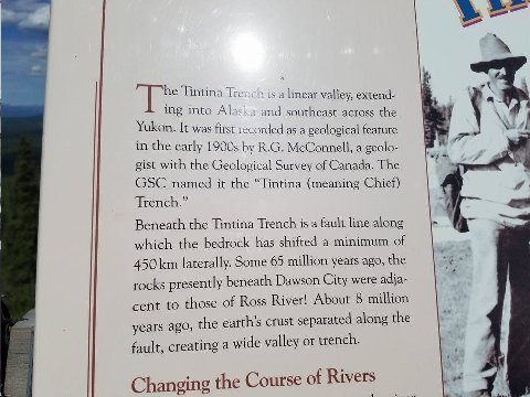
Above: Two Images. Tintina Trench. Klondike Highway. Yukon. 08 June 2017.
The Tintina Trench is a yuge (sic) fault. Tectonics are still active here as up to a third of the land bordering the 800 mile long north west to south east diagonal trench has shifted by mud slide in the last ten thousand years. Slides continue today.
It is not a coincidence that gold was discovered in this region of high tectonic activity. Areas of plate friction are usually associated with rich mineralization.
My image does not do justice to how spectacular is this sight. The Tintina Trench is a giant, visible gash in the earth. The awe that it inspires in me as I gaze over it is similar to that felt during similar experiences of witnessing the Grand Canyon or Blue Nile Canyon in Ethiopia. Those two canyons were carved out by a river. The Tintina Trench was caused by a massive slip between two geological plates.
These geological/geographical phenomena tell me that creation of the earth is ongoing. The questions are begged, when will the Yellowstone Caldera blow? When will the Pacific plate slip under the North American plate?
Recognizing the fragility of the earth mankind needs to be more focused in hedging its survival bets.
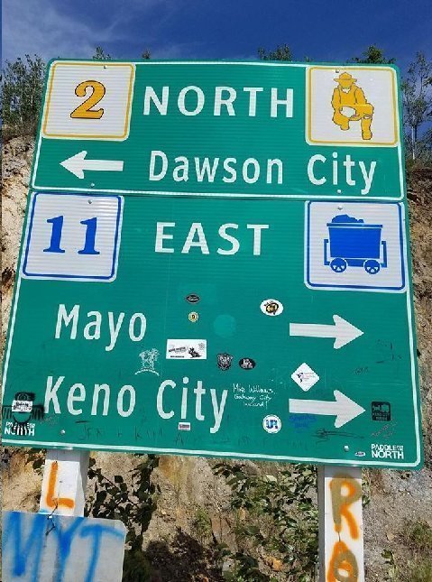
Above: Road sign at Stewart Crossing. Klondike Highway. 08 June 2017.
Bishop leaves his mark.
Above: Placer gold mining tailings. Dawson City. 08 June 2017.
These placer mining tailing piles, aligned along the route of the Klondike River and the Klondike highway, went on for ten miles as I approached Dawson City, where the Klondike flows into the Yukon, while riding my BMW F800GS motorcycle.
For some reason, I thought the oil tanks on either side of the main road that went on for miles Montage and Mwah (sic) riding in a hired car, drove through Sharjah, UAE in 2012. The metaphor is apt... one a gold site... the other a "black gold" site.
In 1898, one hundred thousand would be gold miners were on their way, by steam boat, from Seattle or San Francisco, to Skagway. From Skagway the travelers would climb to the top of the White Pass, seek the headwaters of the Yukon, and build rafts and boats to float them down river, over 400 miles, to Dawson City... where the gold was.
Only thirty thousand of those who set out made it to Dawson City. Some were killed in the rapids of Whitehorse canyon. Others turned back.
Of the thirty thousand men who came to Dawson, only four hundred of them became wealthy on the back of gold discovery.
Some achieved wealth in other ways... portage services, retailing to prospectors... hotels. Jack London, failing to secure a claim, ended up working for other prospectors and became one of America's great authors: "White Fang," To Build a Fire."
Addendum:
That is so gorgeous. You are lucky to have seen it.
Comic Mom,
Park City, UT
Very cool again Steve.
Brand,
Ventura, CA
Hi Steve,
IOMTT is so amazing. What a wild ride! And so insane…isn’t that what makes it so cool?!
I thought you might enjoy this blog post of mine on design, with a nod to Porsche: https://www.linkedin.com/pulse/lead-follow-dw-blog-design-nirvana-david-wiener
David Wiener
David Wiener Ventures
Think Tank • Design Center • Entrepreneurial Guidance
——————————
Park City, UT & Cape Cod, MA • USA
1.435.640.1650 mobile
David Wiener Ventures
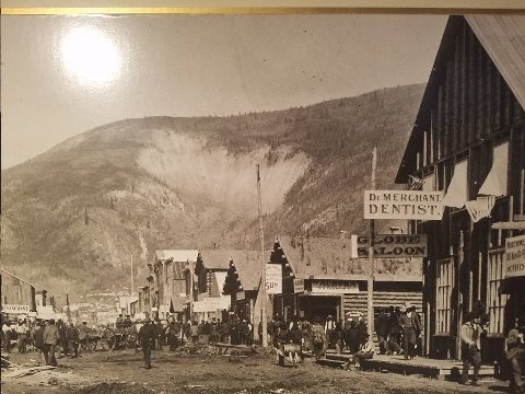
Above: Two images. Front Street, Dawson City, YT. The first, 1898. The second, 09 June 2017.
The only common denominator of the two images is the mountain scar on the mountain called "The Dome."
On first glance I thought the scar derived from the mining days where sand or dirt was quarried for construction purposes. Silly me. The scar is from a landslide from pre historic times.
Dawson sits on the Tintina fault. As I mentioned in yesterday's post about the Tintina Trench, this area has been rife with landslides for centuries. And, gold and other minerals are often found in abundance along fault lines.
As I look at the first image, I try to imagine the scene here one hundred twenty years ago. I have a little understanding of what it takes to get here by land, having ridden up - now 3500 miles and counting - on the F800GS motorcycle. But, the ordeal of steaming up to Skagway from San Francisco, hiking up from Skagway over the White Pass, and then floating 400 plus miles down the Yukon River with over 1000 pounds of stuff per individual, really makes my motorcycle ride seem like a trifle. How times have changed.
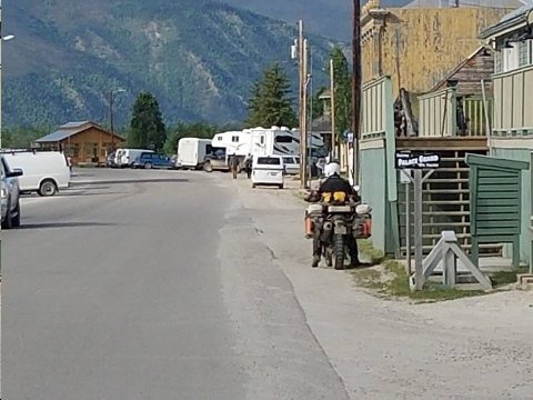
Above: Alan, riding BMW R1200 GS, on Front Street. Dawson, YT. 09 June 2017.
Alan, about 65, is from Victoria, Oz. He was riding his own bike. He started in Seattle three weeks ago. He's on a five month long ride throughout North America. Like me, he plans on riding the Top of the World Highway - destination Tok, Alaska - while he's up here. He's camping throughout his journey.
Riding alone, and so far away, and contemplating a ride on such an obscure road as "Top of the World," one thinks about teaming up when he meets another solitary rider.
But, teaming up is a double edge sword. Different riders have different riding abilities and styles... different ideas about where to stop... how far to ride in one stage. Riding solitary provides a lot of flexibility. You can stop or start when and where you want. When you are curious about something along the side of the road, or see a specific image you want to capture, you can do it without wondering whether or not you are going to screw up your partnership with another (other) rider (s).
"Top of the World Highway," as obscure as it is... has a far amount of traffic including RV's and even busses on tour from as far away as Anchorage... 400 miles from Dawson.
So... though teaming up could be considered... neither Alan nor I raised the prospect.
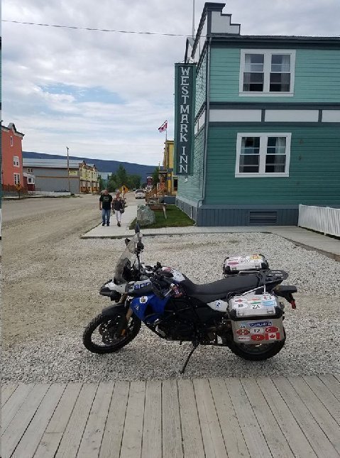
Above: My BMW F800GS motorcycle parked at Westmark Inn, Dawson City, YT. 09 June 2017.
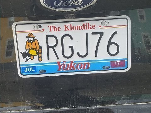
Above: Yukon tag. Dawson City, YT. 09 June 2017.
Gold mining theme.
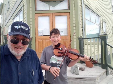
Bishop and Noah. Dawson, YT. 09 June 2017.
Prepubescent musician on the street playing, for tips, 1890's period dance hall tunes.
What an imaginative concept... and a good way for a young kid to make extra money.
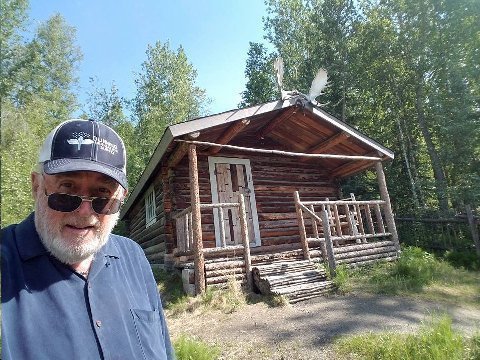
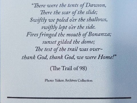
Above: Bishop Robert Service cabin. Dawson, YT. 9 June 2017.
Robert W. Service, "The Bard of the Yukon," a British/Canadian, lived and wrote in this cabin from 1909 to 1912.
Service was the most prolific poet and best selling writer of the 20th century.
Service's best known works are "The Shooting of Dan McGraw," and "The Cremation of Sam McGee."
Interestingly, Service didn't make it to Dawson until 1909, ten years after the peak of the gold rush. But, he spent the previous fifteen years in the western United States and western Canada. He was a bank clerk in Kamloops, BC before he was transferred to Whitehorse, YT in 1907. He knew the old Klondike miners and so he knew the lore. He was impelled to write about those heady days in 1898 before actually living in Dawson at this cabin ten years later.
The brief verse shown on the accompanying image, "The Trail of '98" captures lyrically, in few words, the thrill of reaching "home... Dawson," in 1898, after such an arduous journey. Reading these lines I can understand how Service's economic poetic style caught the imagination of the English speaking public.
Five years ago, TIMDT, our kids families, and Mwah (sic) stopped at Skagway while on an Alaskan cruise. We took the White Pass Railway to the top of the White Pass, then recognizing, only, dimly that the pass had something to do (pre railway) with the 1898 Klondike gold rush.
This motorcycle trip to Dawson has helped me fill in a lot of the blanks in my mind that I had then regarding the great Klondike gold rush.
In 1898, the gold seekers, having arrived in Skagway by steam boat from Seattle and San Francisco, had to climb White Pass (Chilkoot Trail) carrying with them the thousand pounds of gear and food required of them by the Canadian government. They hired horses and mules at exorbitant prices only to find many of the animals perished in the severe cold.
When the would-be miners reached the top of the pass they had to make their way... not too far... to the headwaters of the Yukon River. I rode the F800FS through this Yukon head waters area day before yesterday, to Whitehorse, YT. There they would craft boats, rafts, whatever they could make float, and "sail" down the Yukon, through the Whitehorse rapids, to Dawson. Many gold seekers were killed running the Whitehorse rapids. I visited the site of the rapids, now a smooth flowing water course backed up by a dam built in 1959, two days ago.
From Whitehorse, I rode the motorcycle to the miner's final destination, Dawson City, yesterday. I saw another rapids obstacle along the way: Five Finger Rapids.
One can imagine how these exhausted travelers exulted arriving in Dawson after such an arduous journey. The journey was adventuresome enough for me riding a motorcycle. I marvel at someone on the same quest one hundred twenty years ago.
But, note how beautifully Service' short verse captures how the travelers must have felt at journey's end.
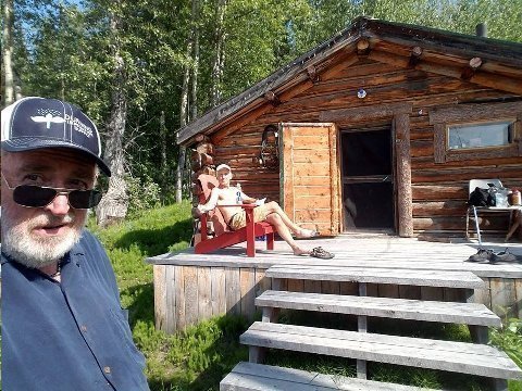
Above: Bishop' 'n Greg. Dawson, YT. 09 June 2017.
I was walking direction down river from Robert Service's cabin. I saw this guy, sunning himself and reading a book on the deck of the pictured old house. We started talking.
Greg was born in Ontario, but, came to the Yukon in his late teens. He's retired. He worked as a heavy equipment operator. He worked on the Dempster Highway, Canada's only highway to go north of the Arctic Circle. He lived in the Dempster highway destination, Inuvik, for nine years.
Greg has a 22 year old daughter. He didn't mention anything about the mother. He goes to Mexico every year during the winter.
Greg said the house is not that old... 1960... but, it is "grandfathered" from having to install sewer and running water.
Here's a life lived!
Addendum:
Had to look up YT...Yukon Territory! Not something we hear often on the east coast!
Bronx Girl, Pelham, NY
HI Steve! Thanks for your wonderful descriptions of the Klondike Trail.
When I grew up in Nashville a few decades ago, we had to learn by heart a number of poems in Junior High School. All the poems had messages for young kids about life. (I don’t find that many curriculums include such today!) I will not likely make the Klondike now but I had to memorize "The Cremation of Sam Mcgee” , probably because he was from Tennessee. (And then there was “Little Giffen of Tennessee, eighteenth battle and he sixteen, smitten with grapeshot and gangrene” — nothing to do with the Klondike, but part of lessons to be learned for a kid in the South.) I devoured Robert Service stuff but when I had to stand up in front of a class I chose part of “Spartacus to the Gladiators”. I still remember this and even declaimed it to 4th graders in Mike Jorgenson’s class for TGE in Heber a few months ago when I gave my talk on a late teenager called to work on the atom bomb —— Regards,
Manhattan,
Park City, UT
Apt (and appreciated) comment considering today's posting.
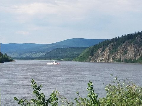
Above: Free ferry across Yukon River from Dawson to west bank. 10 June 2017.
That's my way, this AM, to get to YT 9, Top of the World Highway, from Dawson 65 miles to the AK state line. From there I'll ride 48 miles on AK5, the Taylor Highway, to Chicken, AK for gas and a break. There's a music festival, "Chickenstock," going on in Chicken this weekend. From Chicken, it is 80 miles to Tok, AK, today's riding destination. Half of the day's ride will be on gravel. — in Dawson, Yukon Territory.
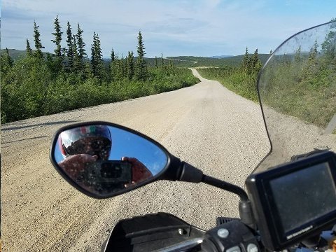
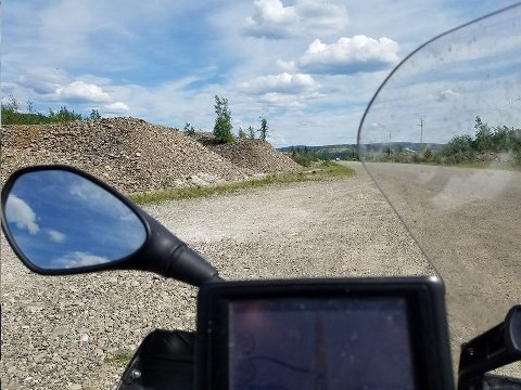
Above: "Top of the World Highway," YT 9. West of Dawson City. Yukon. 10 June 2017.
A way driving/riding from Canada to Alaska NOT using the Alaska Highway!
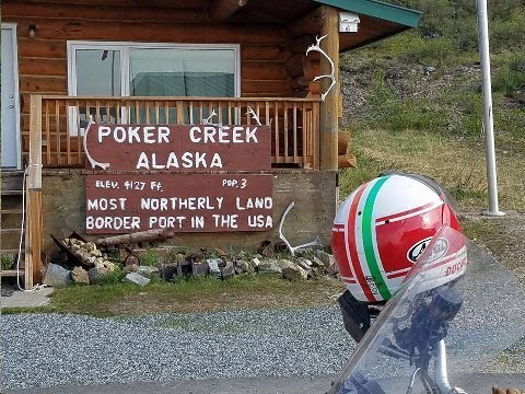
Above: Poker Creek Alaska sign. Poker Creek, AK. 10 June 2017.
No doubt about it. I'm up there (north, I mean).
I have ridden a motorcycle further north than this point. Circa 2010 I rode a Kawasaki KLR motorcycle from Anchorage to Dead Horse, (Prudhoe Bay), with MotoQuest, Phil Freeman's group.
Still, this point has a bit of the iconic in it as well.
I wonder if the US Immigration officials at the border (where the bike, here, is parked) like this assignment? Or, is it like a sentence to outer darkness? Chicken, is 50 miles from here... and, well, Chicken isn't exactly "civilization" itself.

Above: Bishop takes a break at Chicken, AK. 10 June 2017.
"Chickenstock Music Festival" in progress. Lots of campers. Most festival goers come from Fairbanks.
Old gold mining area. A lot of amateur prospectors were panning for gold in the creek along the Taylor Highway, between the Canadian border and Chicken.
Chatted with festival goer Dave. My age. Retired math professor from University of Alaska at Fairbanks. He one upped me on travel stories. I said that recently I had motorcycled from Russia into Georgia, across the Caucasus mountains, on the Georgia Military highway. "Yes," he said, "beautiful road. In the mid '70's my wife and I rented a car in Moscow and drive over the Georgia Military highway to Tbilisi."
Chicken, AK. A good place to be when the mud hits the fan.
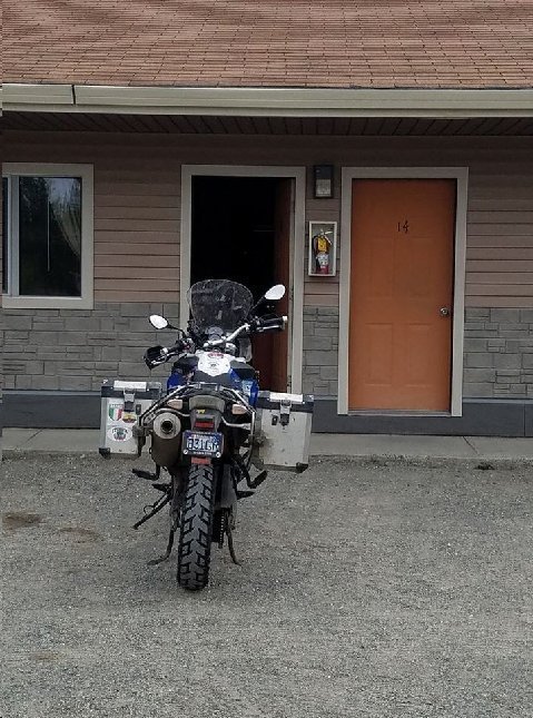
Above: My BMW F800 GS motorcycle at Young's Motel, Tok, AK. 10 June 2017.
My little house in Tok.
Plan was to stay in Tok for a couple of nights, then ride to Haines, where I would also stay for a couple of nights before catching the Inside Passage ferry to Prince Rupert.
Big rain in the forecast. I don't mind riding in the rain... but, the views along the route south from Tok of Wrangell-St Elias National Park (US) and Kluane National Park (Canada) are spectacular. If by delaying the ride a day I can catch the views... I might do that. Good time to catch up on reading, diary, walking etc.
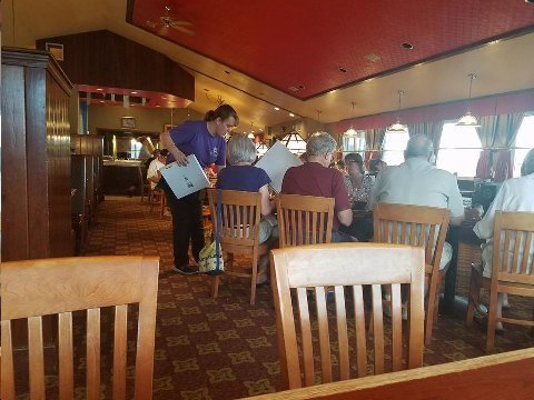
Above: Fast Eddies Restaurant. Tok, AK. 10 June 2017.
Enjoyed Fast Eddies last year... enjoyed it this year. Steaks, chops and pizza type of place.
Iconic. A must stop along the Alaska Highway.
Addendum:
Keep up the great reports. Ironically it snowed a foot today at Tahoe. Fluke storm.
Hideneau,
Reno, NV
A wonderful adventure, certainly understand taking the BMW; not sure why you didn't take a larger one ! Enjoy and most importantly be safe.
MR Z3,
Ojai, CA
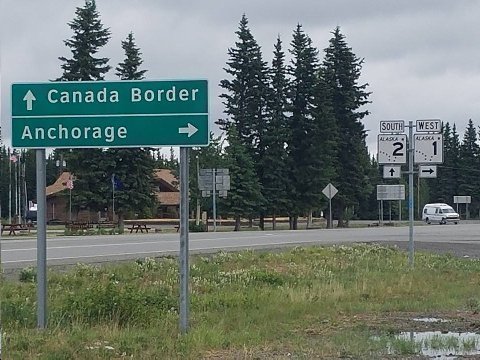
Above: Two images. Road direction signs. Tok, AK. 11/12 June 2017.
Images taken while out for a walk. Chilly and rainy for these two days, slaking a draught around these here parts.
The temperature changes in this region have been off the charts. Day before yesterday, in Dawson, it was 84 degrees. When I checked the weather, there advisories warning of high water at rivers and streams as a result of extra runoff due to the warm weather. Today in Tok, however, the high was 48 degrees.
Last year I spent two nights in Tok. From Tok, I rode the BMW F800 GS motorcycle to Delta Junction and back to Tok to complete the entire distance of the Alaska Highway, and to link with the point of a 2010 ride on a Kawasaki KLR 650 from Deadhorse (Prudhoe Bay) returning to Anchorage via Delta Junction. So, I could say I had ridden a motorcycle the length of the Alaska Highway, from Dawson Creek, BC and beyond, to, crossing the Arctic Circle, Deadhorse, AK.
This year, I had also planned to spend two nights in Tok. Ahn Rhee, from Larkspur, CA, was supposed to be with me (bike breakdown kept him home). We wanted to have the flexibility, to, say, ride to Fairbanks, or Valdez, and back to Tok, each four hundred mile round trips, before continuing on our way to Haines, AK I'd ridden to Fairbank's before, but, had never been to Valdez, terminus of the Alaska Pipeline.
On arriving in Tok alone, the night of 10 June 2017, when I contemplated the extra day open to me (the 11th) I felt, deep down, that the likelihood of a four hundred mile ride would probably have less appeal than a well deserved day off.
So, in Tok, alone, I decided to take the day off 11 June 2017. Besides, there was weather.
It started raining as I was riding from Chicken to Tok on 10 June 2017. Next day, "my day off," there was constant light rain all day long.
My plan called for me to ride from Tok to Haines, AK on 12 June 2017, the next day. I checked the weather and it wasn't going to stop raining in either Tok or stops along the way south to Haines, until the 13th.
I had planned, also, two nights days in Haines: 12th and 13th. So, there was flexibility for me to arrive in Haines a day later than planned, and still connect with the Alaska Maritime Highway System ferry on the 14th, which I had booked to take me to Prince Rupert, BC.
Dilemma. Should I ride the 12th in constant rain for 440 miles, or stay a third night in Tok and ride in the expected better weather the next day?
Riding in the rain would mean no scenery. There are some great vistas on the way down to Haines looking rider's right, southwest, to the Wrangell St. Elias mountains in Alaska, and further down the road, into Canada's Kluane National Park, part of the same coastal mountain system as Wrangell St. Elias.
I opted to stay a third night, 12 June 2017, in Tok. I got some reading done, updated my diary, went for some extended walks, and took my meals at the iconic Fast Eddy's.
Addendum:
The reason the town is called Chicken is interesting. When the founding folks decided to officially register the town the original name was going to be Ptarmigan. As the discussion heated over the proper spelling of the proposed name, there was a frustrated call for a vote and the alternate name was Chicken.
John Galt,
Walla Walla, WA
You are an inspiration. And a grandfather no less! The bar has been set.
Inventor,
Park City, UT
Tell that to TIMDT. :-)
Wonderful travelogue and wonderful pictures - thanks very much.
Nathans,
Massapequa, NY
Quite the adventure! I love the daily travel logs so that I can enjoy your travels vicariously. Be careful especially on the wet roads.
Captain Kirk,
Park City, UT
Amazing scenery- keep the pictures coming
Read a review on a Book you may enjoy “The Long Haul” a truckers tale of life on the road by Finn Murphy.
Montage, Marina del Rey, CA
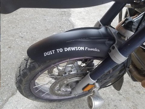
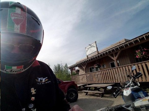
Above: Fighter's bike. R1200 GS. Fast Eddy's. Tok, AK. 13 June 2017.
"Fighter" is the founder of the "Dust to Dawson" motorcycle rally, held this year in Dawson on 15, 16 June 2017.
"Dust to Dawson" has an iconic reputation for adventure riders. Remember the German couple from Cologne in Teslin BC, riding the disabled PD with a busted starter? "Dust to Dawson" was where they were headed.
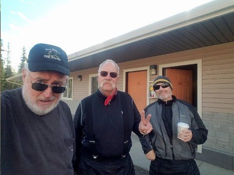
Above: Bishop, Fighter and Jerry. Young's Motel. Tok, AK. 13 June 2017.
Chance meeting.
Fighter, a retired Anchorage school teacher, is the founder and current impresario of the "Dust to Dawson" motorcycle rally.
Jerry, his riding buddy, is an Anchorage architect.
All of us are riding the Alaska Highway south today. Fighter and Jerry are riding to Whitehorse, YT, about 400 miles. My ride will veer south from Haines Junction to the Haines Highway and take me to Haines, AK... total 440 miles, about 300 of which will be in Canada/Yukon.
Its a funny thing. I'm riding 440 miles from Alaska to Alaska, through Canada! Or, stated another way, I'm riding from Canada, 300 miles south (!), to get to Alaska! Check the map. The geography and road system of this area is interesting!
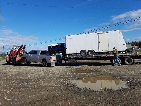
Above: Jeff, on phone, next to his Ram and trailer rig. Willard's Towing, Tok, AK. 13 June 2017.
Jeff and I had breakfast together at Fast Eddy's. He told me his story.
"I didn't get in last night until near midnight.
I was making my 49th annual run bringing up a load of building siding from Seattle when my Ram truck just stopped. I was 80 miles south of Tok just this side of the Canada / US line. The truck just stopped. This has never happened to me in 49 years of doing this every year.
I don't know what I'd have done if the break down happened in Canada. Neither Canada nor the US will allow tow trucks from the other country into their own country. I guess I'd have had to get a Canadian tow truck from Beaver Creek, YT to pick me up, take me to the border and then hook up with an American tow truck from Tok.
I was lucky. There were a couple of locals who stopped and asked if I needed help. They had a land line at their remote house, five miles away. They let me call Willards. There is no cell coverage out there.
I live in Soldatna, Kenai Peninsula. I called my wife. She said she had gone fishing in the Kenai river yesterday and caught six salmon. She told me, 'we'll see you when we see you. I'm going fishing again.'
Look. I was pretty close to the weight limit. I was worried that the inspection station on the US side of the border was open and that I would get stopped because I was overweight. Fortunately the station was closed.
All of this on top of the fact that I got food poisoning in Seattle. I was really sick driving up. I tried to keep hydrated drinking everything from Coke to Insure. Finally, I saw a doctor in Fort Nelson, BC. He castigated me for not seeking help sooner, gave me a prescription for antibiotics, and sent me on my way. I've felt a little better since being on the antibiotics.
I don't know how long I'll be here in Tok. Willard doesn't have a good reputation for working fast on stuff. He gets to it when he gets to it."
Another story along the Alaska Highway.
Above: Mike, Oakland, CA, and Bishop. Beaver Creek, YT. 13 June 2017.
Mike riding a Kawasaki KLR 650, coming from the south. Mwah (sic) was riding my BMW F800 GS coming from the north.
Serendipitous meet-up in remote Beaver Creek, YT of two solitary riders along the Alaska Highway.
Like Mwah (sic), Mike had ridden up the Cassiar Highway to link up with the Alaska Highway in Watson Lake, YT. He was on his third solitary ride to Alaska.
I had thought it was going to be sunny today, but Mike said, "you better don your rain gear. There is rain on the way down the road."
Mike said he'd been riding the last three days in the cold and the rain, the same period I was holed up in Tok, waiting out the rain. Mike says, "I'm not sure how many more times I want to do this [ride a motorcycle to Alaska]. Its been damn cold!"
I put on my rain overpants and rain gloves. My Klim riding jacket is water proof.
Above: Gas stop. Pee break. Destruction Bay, YT. 13 June 2017.
That's Fighter in the image, futzing with his bike at the gas pump. My F800 GS is at right.
Destruction bay is 220 miles south of Tok on the Alaska Highway.
Mike, from Oakland, was right. It rained intermittently from Beaver Creek to Destruction Bay.
There was four miles of construction. I had to ride the first half of the construction segment through newly graded, wet dirt. The surface was soft and mushy. This was not fun. The second segment, was not fun either... hard pan reduced to mud. Squiggling and squirming me 'n the bike made it through.
Last year on this same road segment, there was forty miles of construction dirt. But, I had an easier time on that forty mile dirt segment than I did on this year's four mile newly graded and mud segment.
Its cold. The thermometer shows between 45 and 50 degrees, depending on elevation. I have a fleece under the Klim outer jacket. My body core is starting to cool a bit... but, I have a high threshold of "pain." I keep riding. I'll don another layer in Haines Junction, 65 miles down the road.
Well, the weather didn't get as good as I thought it would when I decided to stay an extra day in Tok. But, at least the rain is now intermittent and, periodically, there are pretty good scenic views newly snow capped peaks to the right, in Kluane National Park.
Above: Haines Highway. Yukon, Canada. 13 June 2017.
Stunning road!
Two full sized black bears hanging out on my side of the road a few miles back.
I rode the Haines Highway in the same direction about this time last year.
Superlatives don't do justice to either the road engineering or the relentlessly spectacular, unfolding scenery. The entire 150 mile ride of the Haines Highway goes quickly because at each turn a dazzling view floods the mind.
Today, before picking up the Haines Highway, I rode the 300 mile long section of the Alaska Highway from Tok, AK to Haines Junction, YT. But for the four miles of construction mud, the road was "ok" but full of frost heaves, filled pot holes and patching.
The Haines Highway road surface, by contrast, was smooth as a baby's bum for its entire 150 mile length.
For fifty miles, the Haines Highway runs southward along the eastern border of Canada's Kluane National Park. There are turnouts for scenic viewing. Though I couldn't see it today because of cloud and mist occlusion, the 18K foot Mt. Logan is in Kluane.
So, 10 of 10 for road quality and 9 of 10 (today because of mists) for scenery.
Because of the remote location of this highway, built during WWII as a supply route from Haines port to the Alaska Highway, few will ever get to see it.
Addendum:
Super.
Many thanks for sharing . . frequently share with my family.
Hand,
San Jose, CA
Steve, another excellent book you should check out is Into the Silence by Wade Davis. It's about George Mallory, and the efforts to climb Everest. Mallory was a fascinating character, and WWI features prominently in his story. I learned more about WWI than I ever wanted to know from reading this. Davis is also a superb writer.
As an aside, about 30 years ago, we did an Alaska cruise aboard the Noordam.
Zookeeper,
Williamstown, MA
Love your summaries. I am more of a WWII aficionado. Just finished an excellent book about a major part of the war that is often forgotten, the Italian front. It is, Beneath A Scarlet Sky, by Mark Sullivan, based on interviews with the main character/focus of the book -- a bigger that life true hero. Pino Lella lived a long time and continued his colorful life. At the beginning of the war he starts off as just a kid leading Jews across the Alps to escape into Switzerland. Ends up as a spy and driver of the Nazi general who is chief of logistics in Italy. It is a factually based novel, with mostly real names, incidents and places. Good read.
Jarhead,
Cabo St. Lucas, Mexico
Steve,
I tried to visualize your Thomas Jefferson writing desk on motorcycle. Good review.
For those who like to say "I did not read the book,
I saw the movie:"http://www.pbs.org/wgbh/americanexperience/films/great-war/
The Cardinal,
Los Angeles, CA
Thanks. Good analysis of what makes the Reacher books so terrific and the movie just so so. I've read all of the Reacher books too but was not going to buy this one figuring it contains stories that never developed into novels. I'll buy it now (after I finish reading 3 history books I recently started - Churchill, Hawaii, Knights of Malta).
Nathans,
Massapequa, NY
The southbound ferry, from Haines, AK to Prince Rupert, BC wasn't leaving until 11:30 PM. So, I had a full day to kill in Haines. I was able to arrange for a 4:00 PM checkout at the Aspen Springs Hotel. The ferry would arrive in Prince Rupert at 1:00 PM on 16 June 2017.
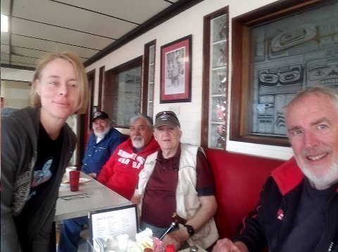
Above: ROMEOs and Shannon at Bamboo Room breakfast. Haines, AK. 14 June 2017.
I had breakfast with these guys about this time last year at Bamboo Room. Buddies of John Galt.
Shannon, and Australian, waitress, has been in Haines for two years. She was married to a Silicon Valley type, got divorced, and has been roaming around the world with her dog.
Alaska stories!
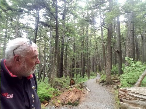
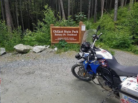
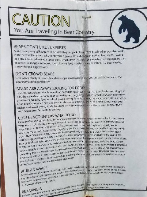
Above: Three images from aborted hike at Chilkat State Park. Haines, AK. 14 June 2017.
I went about a quarter mile down the beautiful, coastal rain forest trail, but, couldn't get the bear warning sign out of my head. This was something I had not better do alone, I thought. Then, I turned back.
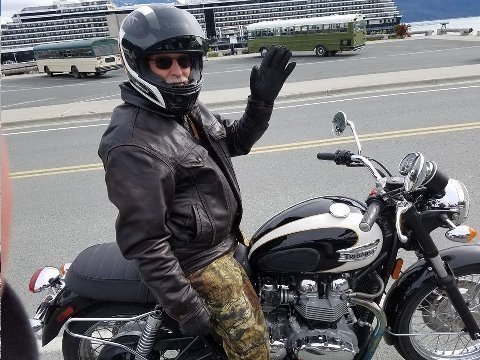
Above: Bill S. Haines, AK. 14 June 2017.
Astride my BMW F800GS motorcycle, I was stopped by the side of the road checking a map.
Bill pulled up on his spiffy (new?) Triumph motorcycle (Bonneville?).
At first, I thought Bill was someone I might know. But, no, I hadn't met him. He was a local guy on a bike being friendly with another motorcyclist. Seeing a Utah tag on my motorcycle in Haines was probably a curiosity he couldn't resist exploring further.
Bill, a Haines resident, had been riding (not the Triumph) a BMW 650 up in Dawson when I was there.
"Did you try the Dempster Highway," I asked?
"Yes," he said. "It was horrific. Mud under gravel."
Alan of Oz, riding the 1200GS, had told me the same thing when I talked to him in Dawson.
Fighter had replied, when I asked him about the Dempster, "depends on the weather."
It looks like the Dempster is possible for a motorcycle... but, only after a week or so of dry weather.
I haven't totally discarded the notion of attempting the Dempster. This highway, however, I wouldn't try alone.
I asked Bill if he knew former Haines resident John Galt. "Yes," he enthused, "good guy!"
Alaska (or Yukon, just as good) stories!
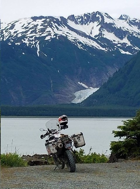
Above: Davidson Glacier and my BMW F800GS motorcycle. Chilkat State Park. Haines, AK 14 June 2017.
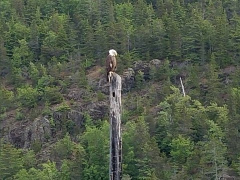
Above: Haines Sparrow (er... bald eagle). Chilkat State Park, Mud Flat, Alaska. 14 June 2017.
Haines Chamber of Commerce bills Haines as the "eagle center of Alaska." When the Chinook spawn on the nearby Chilkat River, as many as 4000 eagles have been spotted from one position by the river.
Mr. Z3 and Mwah (sic) did a self guided motorcycle tour, (KLR 650) on the Kenai Peninsula five or six years ago. In Homer, AK, the eagles were ubiquitous. I said then, "eagles are the Alaskan sparrow."
The eagle pictured here is one of a half dozen bald eagles I saw while wandering around Haines.
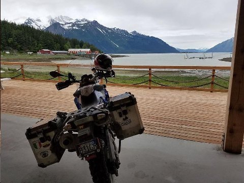
Above: Mud Bay. My BMW F800GS motorcycle. Haines, AK. 14 June 2017.
Houston, Haines has a problem: lowering sea level. Actually, rising earth. Post glacial rebound. Earth recovers still, ever dynamic, from the weight of the ice cover during the last ice age, 15K years ago.
Here at Mud Bay, the sea lowers one inch a year. Steamers came into mud bay 100 years ago. Big boats can't come here these days.
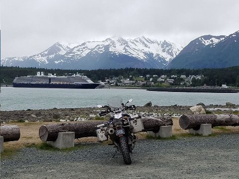
Above: Holland America cruise ship Noordam. Haines, AK. 14 June 2017.
Most large cruise ships coming this far, to the "top" of the Inside Passage, stop in Skagway... 40 minutes by ferry... 9 hours by car (north on the Haines Highway, southeast on the Alaska Highway, then, southwest on the Klondike Highway).
Skagway, best known as the first major way point for the 1898 gold seekers coming by steamer from San Francisco or Seattle, has parlayed its history into a true tourist town, retaining the patina of gold rush days: jewelry stores, saloons, t-shirt stores, and even, I'm told by a local Haines person, hookers.
TIMDT, Mwah (sic), our children and grandchildren stopped in Skagway on our Alaska cruise five years ago.
For me, the highlight of the Skagway stop five years ago was the ride on the White Pass Railway to the top of White Pass. That train ride today follows the route of the Chilcoot Trail, the arduous climb from Skagway to the headwaters of the Yukon River, trekked by the 1898 gold rush participants.
Where Skagway gets two to three cruise ships a day, Haines, during cruise season gets only two to three ships a week.
Haines residents that I talk to about the cruise tourist business seem ambivalent. Locals understand the economic benefits of tourism, but enjoy the isolated, rough and tumble Alaskan authenticity of Haines... which, they say, is lacking in Skagway.
Haines reeks of Alaskan out back, where Skagway seems "amusement park" contrived. Haines started as a mining camp, became a timber camp, a base for road building (Haines Highway), supply and fuel deliveries to the Alaska Highway during WWII, and finally what it is today, an economically struggling fishing town trying to subsist on as much "Ted Stevens" federal money as it can get their hands on. The Feds are paying for the dredging of the fishing/recreational boat harbor there, for example.
Then, again, there is the amazing geography of the Inside Passage area of Alaska. Haines and Skagway are separated from one another by a 45 minute boat/ferry ride. They are eight hours separated by highway!
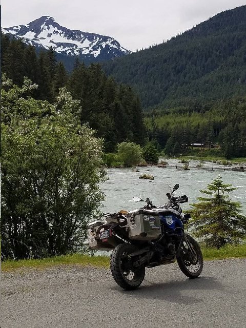
Above: F800 GS motorcycle parked by Chilkat River. Haines, AK. 14 June 2017.
Soon to be brimming with Chinook salmon.
Amazing thing. The genetic make up of the Chinook which come up this river. The same schools fish and their progeny make it to the same river, every year.
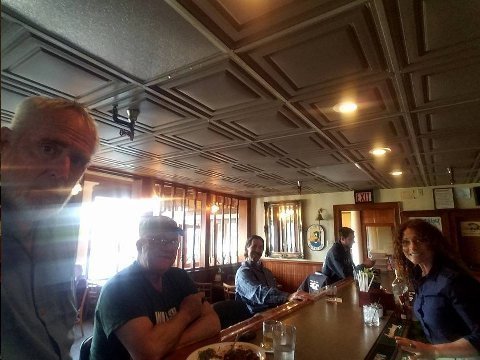
Above: Bar, Hanserling Hotel. Haines Alaska. 14 June 2017.
In the image: The Bishop, Don, Mark, and bartender Candace.
I met Don and Mark last year in Haines when I was riding with John Galt, Earp, and Cal Poly. They're good friends of John Galt and Dagny Taggart, who lived in Haines for fifteen years before moving to Walla Walla, WA.
This trip, Galt put me in touch with Mark who invited me to the Hanserling Hotel for a drink and dinner. Don, who just happened to be there, joined in our conversation once we had jointly remembered our encounter last year at breakfast at the Bamboo Room.
I can see why Galt got along so well with these guys. They're guys who know how to do stuff. Don was an Alaska back country guide for fifty years and Mark is a retired oil tanker captain.
I was curious about the spectacular scenery I saw from a distance in Kluane National Park while riding down the Haines Highway. Canada's highest mountain, Logan (18K feet) is in Kluane.
Don recounted how he had spent a lot of time in Kluane. He told me if I wanted to go there, there were plane or chopper pilots who regularly went into those remote areas. This got me thinking about a next visit and a longer stay to see remote areas.
Mark's tanker sailing routes took him everywhere. Mostly he sailed between Valdez and Panama. But, he took ships to Singapore for maintenance and once sailed a giant oil tanker around Cape Horn. "The weather was great the day we did it," he said.
Mark's wife is an inside passage pilot sanctioned by the state of Alaska. She's away 21 days a month during the summer sailing up and down the passage on the big cruise ships.
Mark was a well spring of local knowledge. I asked him how Haines got its power. "There's a hydro plant on a river up by Skagway. Power is brought from there to Haines by an underwater cable that skirts the short coast line from Skagway to Haines. If something happens to that power supply, there's a large diesel generator here in Haines that can power the whole town.
In a world where so much of the "narrative" is political BS separated from the world of reality, its a real pleasure hanging out with "guys who know how to do stuff," guys who live in the real world... guys from whom assistance will be sought when the mud hits the fan.
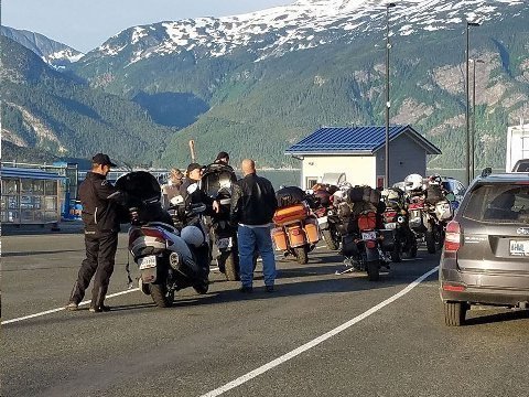
Above: Alaska riders await the ferry to Prince Rupert, BC. Haines, AK. 14 June 2017
Alaska and Yukon riders from the lower forty-eight are an amazing bunch. In some ways they remind me of the turn of the century Yukon gold seekers. The lure of far north adventure suffuses the psyches of the restless today as well as then. Only today, its motorcycle adventure, not gold.
Alaska Yukon motorcycle travel winnows out the most hardy (read crazy?) of motorcycle adventure travelers. I want to identify with these adventure riders, but, can't quite see myself on their level. Most of them camp. I do motels and hotels. Most of them are probably better at dealing with mechanical incidents than am I.
Wherever I ride alone, I try to keep my riding to roads which I know will be reasonably trafficked. If I have a mechanical incident or a flat tire that I can't deal with (or find someone to help me with), I can always say goodbye to the bike, leave it at the side of the road and hitch a ride... and, work my way home.
Amongst the group in the image are Steve and Dave from Phoenix, AZ. Both have ridden their Suzuki 650 V-Strom motorcycles as far as Prudhoe Bay, and now are on the return (to Phoenix). They are campers (bears?).
We talk rubber. The three of us are riding Hidenau tires. We speculate as to whether we'll need to swap out tires before we get home. I've worn less rubber than Dave and Steve, but, more than I thought I would compared to my memory of last year's rubber status while at this stage of the trip.
"We got new Hidenaus in Calgary," says the voluble Steve. "We rode up via Edmunton," he says. "Don't ever go that way. The freeway from Calgary to Edmunton, apart from being crowded, is the most boring road I've ever ridden. Its like riding in Kansas."
We all think that we'll be able to make it the rest of the way home on the current tires. Dave and Steve have 700 hundred more miles to go than I do (distance from Park City to Phoenix).
Steve on the Dalton Highway: "At Coldfoot it started to snow. We started riding north, notwithstanding, because the snow was light and not accumulating on the road. It was 25 degrees!"
"Over Atigan Pass (The Brooks Range), the snow intensified and started to accumulate a bit on the road. The temperature had declined to 20 degrees."
"Thirty miles from Deadhorse (Prudhoe Bay) the road had been washed out for long stretches by flooding in warm weather the week before. Some oncoming haul truckers told us to be very careful of bad road surface the final stint into Deadhorse."
"The road was, indeed, terrible.. the cold remained, but the snowfall let up."
"Interestingly, the worst snow we experienced on our trip was a late spring storm on US 89 in Manti, Utah!"
Steve: "Somewhere near Valdez, Dave got a screw buried into his front tire. V-Strom tires are tubeless, so we fixed it with a plug. When we got to Anchorage, the tire had lost 10 pounds of air. We put some tire repair goop in the tire, and it has been working fine ever since."
Mwah (sic): "Did you guys contemplate ridingIn the Dempster Highway to Inuvik? I've talked to three guys on this trip about the ride. Two of them rode up twenty to thirty miles (the total route is 400 miles to above the Arctic Circle) and then turned back. They said the route was mud under gravel and made for impossible riding. The third guy, who is from Anchorage, Fighter, the founder of the Dust to Dawson motorcycle event, said, 'depends on the weather. If the Dempster is dry, the riding is fine. I've been up there a couple of times.'"
Steve: "Yeah, we thought about The Dempster. We heard that the biggest problem for bikes was shale rock which would cut into the tire. The guys we talked to said if you're going that route, you should bring an extra tire. But, we didn't do that route this time. Maybe next time."
Motorcycle stories! Fish stories! Guys shoveling sh... Part of the fun.
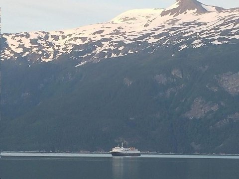
Above: Alaska Maritime Highway System ferry, Matanuska. Haines, AK. 14 June 2017.
Matanuska nears Haines ferry terminal on its way from Skagway, AK. Only 45 minutes by water separate Haines, AK from Skagway, AK.
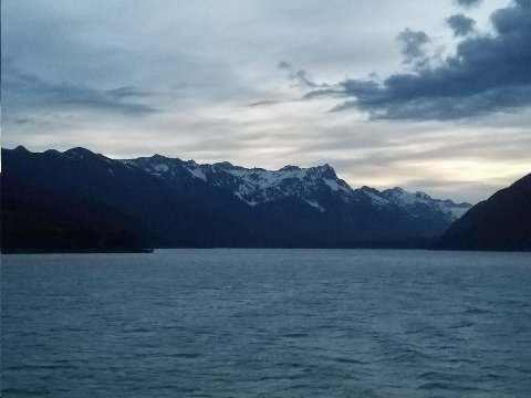
Above: "Sunset." Haines Ferry Terminal. 14 June 2017.
Image looks north!
It won't get dark tonight. At 3:00 AM the surroundings will be visible. Its kind of like dusk all evening. The furthest north I've overnighted on this trip was in Dawson City, YT, 450 hundred miles north of Haines. There, the overnight "dusk" was lighter.
I remember my KLR motorcycle ride to Prudhoe Bay, well above the Arctic Circle, with Phil Freeman's MotoDiscovery tours, seven or eight years ago. In Deadhorse, about this time of year, the sun never went down. I would get up in the middle of the night to see a man about a dog, pull the curtain back on the window, and see "daylight!" This is still a wow for me. I traveled to Leningrad (now St. Petersburg) during summer 1964. I have vivid memories, then I was a teenager, walking outside at midnight when the sun was just below the horizon.
I'm told people who live in zones of day long darkness and day long light have higher incidences of mental illness... that there is also a higher rate of alcohol consumption than "normal."
Addendum:
Good Choice ! Rain 🙈
Mr. Z3,
Ojai, CA
Glad you are able to accompany other riders during parts of your trip, but isn't it dangerous to be riding alone? Accidents, illness, robbery, natural disasters are all possible and nobody would be there to help. Hopefully you carry first aid and weapon protection?
Nathans,
Massapequa, NY
Foreigners can't carry a gun in Canada without registration, which is nigh on to impossible for a foreigner to do. Many US motorcyclists riding in the US carry.
Steve,
The main reason the Haines Highway is in such good condition is that the US taxpayers fund the maintenance under the "Shakwak Agreement."
John Galt,
Walla Walla, WA
So, that explains it. US building highways in Canada!
PS. I'm very appreciative to you and Dagny Taggert for helping to bring Haines to life for me.
Mary Zimmerman directs a fantastic play. I've never seen Odyssey and this one is so imaginative and creative in movement and action. When you come back I recommend seeing it. It's in outdoor theater which adds to charm.
Henry 4 part 2 hasn't opened yet. Saw first act of Merry Wives - silly but good.
Love your trip. Been following on Maps to learn about areas crossed.
Cheer
Aunt Joyce,
Ashland, OR
Good incentive for a repeat trip before Oregon Shakespeare Festival season end.
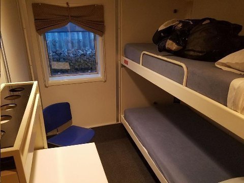
Above: Bishop's cabin. Alaska Maritime Highway System ferry, Matanuska. 15 June 2017.
Spartan but clean. Bring your own soap and towels. I fit fine in the lower bed and got two reasonably good nights of sleep.
Ferry departed Haines, AK at 11:30 PM on the 14th, and arrived at 1:00 PM on 16 June 2017 at Prince Rupert, BC.
Not everyone who travels this ferry wants a room. The two Arizona riders with whom I became acquainted pitched their tent on the fantail of the ferry. Others, would sprawl out on the floor in one of the lounges.
An individual ticket is not expensive... $150 or some such. But, the cost to ship the motorcycle is over $200 and the cabin (originally to be shared by Ahn Rhee) is $250. So, the cost can add up.
There was a cafeteria serving hot meals. Fine, all things considered. I spent quite a bit of time in the cafeteria. It was large, bright. I could "work at my desk" using one of the tables. And, the visibility of the Inside Passage on either side was excellent from where I was seated.
Throughout the daylight hours of the ferry passage, the weather was grim. Gray and rainy. Islands and coastline only half emerged through the gray mists.
You can take a ferry from Haines to Bellingham, WA, about double the distance of Haines to 'Rupert.
Last year we arrived at 'Rupert at 3:00 AM. After going for coffee and a bagel at an all night Tim Horton, re rode on, down BC 16. We turned south at Prince George on BC 97 and rode to Quesnel. Total distance approaching 500 miles.
This time, I wanted to check out Prince Rupert, so I booked a night's stay there. Also, I reserved a room at Smithers, 200 miles down BC 16 from 'Rupert. There is a ski resort in Smithers. I wanted to check it out... to find out if a ski resort, this far north... this far 'out of the way' could be any good.
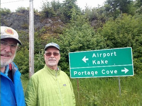
Above: Bishop and Dave at Kake, AK. 15 August 2017.
Dave is one of the "Arizona guys" who rode their Suzuki 650 V-Stroms up to Prudhoe Bay, and pitched a tent on the fantail of the Matanuska.
Dave worked for a living... as a heavy equipment operator for the city of Phoenix. He raised a family and played by the rules. I didn't get a picture of Dave's buddy, Steve, a retired Phoenix cop, who now teaches law enforcement at a community college in Phoenix.
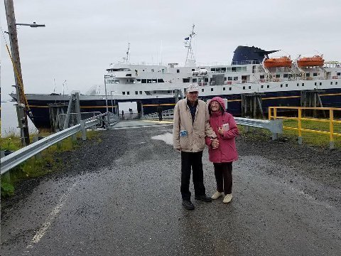
Above: Richard and Laura. Matanuska ferry. Kake, AK. 15 June 2017.
Kake is a small fishing community on the northwest side of Kupreanof Island. Petersburg, a larger town, is on the east side of Kupreanof Island.
I had met Richard and Lara at Chilcoot Lake Recreation Site, near Haines, yesterday.
Both widowed and retired, they are grade school friends from Idaho who have hooked up late in life. Laura still lives in Idaho and Richard lives in eastern Washington state. They worked for a living, raised families and believed in playing by the rules.
Kake is an irregular stop for the Matanuska. Last year, the ferry stopped at Wrangell for its one irregular stop of the route down the Inside Passage.
As the ferry approached the Kake pier, Richard and I were standing on the deck awaiting watching the docking operation.
Richard said he worked in Kake as a logger 59 years ago. He was a teenager, then.
"Well," I said, "you're probably looking forward to getting off during the half hour stop, to put your feet on the ground and close the loop of your returning to Kake!"
"No," Richard said, "I can't walk very well. Laura is not strong enough to help me if I get into trouble."
"Absolutely not," I said. "I'm going with you. I'll help you. You can't return to Kake after 59 years and not set foot on the ground!"
So, Richard agreed to let me help him and he, gimpy to be sure, closed the loop by setting foot on Kake soil.
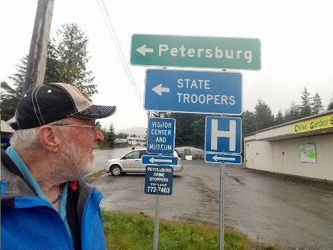
Above: Bishop in Petersburg, AK. 15 June 2017.
The ferry stops in these small downs didn't last long. You could only go ashore for 30 minutes.
Only a handful of people who had booked onward travel got off the ferry to look around on these short layovers.
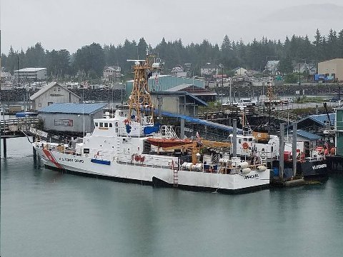
Above: Coast Guard cutter. Petersburg, AK. 15 June 2017.
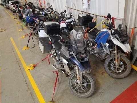
Above: Tied down motorcycles. Belly of ferry Matanuska. 16 June 2017.
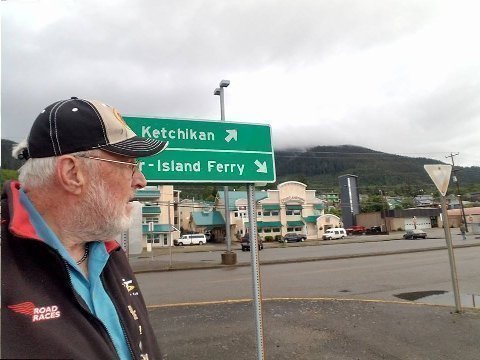
Above: Bishop alights at Ketchikan, AK 16 June 2017.
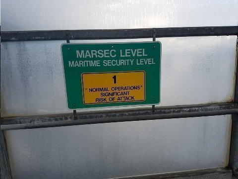
Above: Sign at Ketchikan ferry pier. Ketchikan, AK 16 June 2017.
Huh?
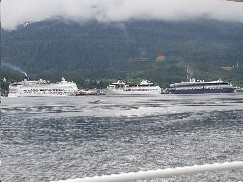
Above: Cruise liners berthed at Ketchikan. 16 June 2017
Alaska cruising. Big business.

Above: Prince Rupert harbor. Prince Rupert, BC. 16 June 2017.
Canada's furthest north ice-free port. Also, claims to be third deepest harbor in the world.
Canadian National Railways (CNR) has a rail spur that starts at Prince Rupert and joins the transcontinental CNR system at Jasper, BC. Consequently, despite its isolation, Prince Rupert is an important commercial port, complementing Vancouver, BC.
Addendum:
I and several other people from Park City bikers made many trips on the ferry it was always enjoyable place to share stories smoke good cigars and drink scotch , Ferry was always very comfortable and include interesting folks & excellent poker games-:) the rooms were far nicer than the ones on the ferry in Mexico on the sea of Cortez, Steve may want to share the story !!
Mr. Z3,
Ojai, CA
Ten years ago. Motorcycling with a Park City crowd. Ferry from Guaymus, Mexico across the sea of Cortez to Santa Rosalita, Baja pitched and rolled the whole of the overnight journey. I was sick as a dog the whole overnight crossing.
Concur with the Dempster comments - no problem going north (dry), but a real mess coming out, especially the ninety miles of Ogilvie Ridge in rain and snow - after twenty minutes almost too slick to stand up, mud packed front wheels. We were very happy to get back out to Dawson. The "fractured face" gravel goes after tires like razor blades - go tubeless with a good tire pump and lots of plugs.
The Colonel,
Bountiful, UT
happy Father's Day. Thanks for the great photos. The scenery is beautiful!
Bridge,
Palm Beach, FL
Another fabulous post. It makes my pulse uptick.
Peterbilt,
Salt Lake City, UT
Cool. Circumnavigated the state off road 😎
Brand,
Ventura, CA
Great shot!
The Inventor,
Park City, UT
We've enjoyed your daily journal and pics...what a great adventure you've had! Safe travels back to PC. Looking forward to seeing you.
Maui and 'Cake
Park City, UT
Steve -
I've missed your posts the last week or so. But you're in country I know well.
Hell, I was first in Chicken and Dawson in 1971 and at the Chickenstock festival in 2007 -- and I've still go the T-shirt to prove it. I hope you got to meet Mike & Lu Busby at the Chicken Gold Camp -- they are good friends. And I hope you stopped by the Chicken Creek Saloon for some more of the local flavor. Is Randy still tending bar there? If so, beware, I've got a few good stories. Did you catch the Robert Service recital in Dawson City -- the last time I was there the guy who played Service could have filled the house on Broadway in New York for a year or two. And I hope you had the onion rings with your burger at Fast Eddie's in Tok -- definitely a stop to be made every time through town.
I've spent big chunks of my career doing mineral exploration on either side of the Taylor Highway in Alaska and some of it in the Yukon. Big country up there! It looks like you had great weather too!
Looking forward to your return to PC to go over your latest travels.
Billy Barker,
Park City, UT
Shoulda had your guidelines before I went!
Last year, I rode my BMW F800 GS from Park City to Delta Junction, AK, the length of the Alaska Highway.
Why do an Alaska motorcycle ride again this year?
Different route. Different ultimate destination - Dawson, YT. I love being up in that part of the world. This alternative routing would give me a chance to see different things... learn new stuff!
My Yukon/Alaska ride was not intended to be a solitary ride. My friend Ahn Rhee, from Larkspur, CA was going to join, until his motorcycle conked out as he was riding up from Larkspur to meet me in Ashland, OR where I had been seeing OSF plays with Aunt Joyce. Ahn Rhee bailed, saying he wouldn't be able to get his bike up and running again in time to catch up. He thought the problem on his KTM 950 Adventure motorcycle was a defective fuel pump. His motorcycle just stop working. He had to have the bike towed over one hundred miles back to his home.
At first, hearing that I wouldn't have a riding companion, I contemplated bagging the trip. But, before I decided whether or not to ride home to Park City, I had agreed to stop off at John Galt's and Dagny Taggert's house in Walla Walla, WA on my way up north, so, at least, I decided, I should make that rendezvous.
As I rode through the heretofore unfamiliar hilly terrain of central Oregon on the way to Walla Walla, WA, I had time for self reflection. I had planned the Yukon/Alaska trip... most of the key reservations had already been made, the bike was riding well, and I had some familiarity with the destinations. By the time I reached Walla Walla, I decided I would make the trip solo.
Different routes... different destinations. In lieu of riding the Alaska Highway from its beginning, at Dawson Creek, BC, I rode the Cassier Highway, from Kilwanga BC, to Watson Lake, YT, where I connected with the Alaska Highway.
Also, rather than continue on up the Alaska Highway from Whitehorse, YT, as I did last year, I rode north to Dawson, YT, before cutting over to Tok, AK using the Top of the World Highway (YT) and the Taylor Highway (AK) to Tok, AK.
Combined with a visit to Skagway, AK, which I made while on a cruise a few years ago, this year's motorcycle trip, following the Yukon River, from Whitehorse to Dawson, YT, gave me a sense of the path followed by the gold seekers of the great Yukon gold rush of 1898.
There were other things I did differently this year as compared to last year. I wanted to spend a little time in Prince Rupert, for one.
Last year, starting from Haines, we (John Galt, Earp, Cal Poly and myself) arrived at Prince Rupert via Ferry Matanuska, at 2:00 AM. After coffee and a bagel at an all night Tim Horton's, we rode on without getting much of a sense of the town.
So, this time, one year later, I booked The Crest Hotel in Prince Rupert for an overnight stay. Matanuska arrived at 1:00 PM. I had plenty of time to check into the hotel and go for a walk to check out the town.
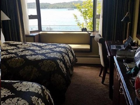
Above: Crest Hotel room. Prince Rupert, BC. 16 June 2017.
Cool. They put binoculars in the room to look at hump back whales in Skeena River inlet.
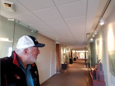
Above: Museum of Northern British Columbia. Prince Rupert. 16 June 2017.
Mostly background and art pieces from Native American history of the area. In Canada, Native Americans are referred to as First Nation members.
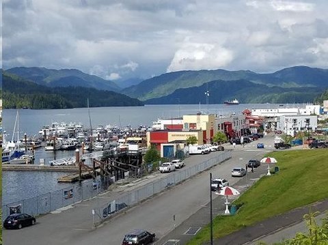
Above: Prince Rupert Marina. Skeena River Estuary. Prince Rupert. 16 June 2017.
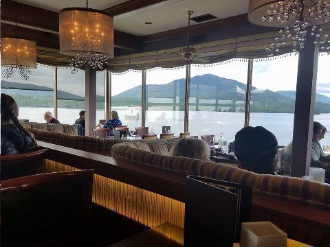
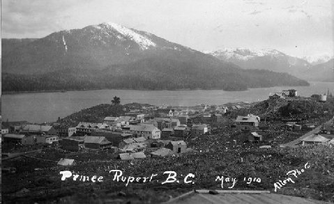
Above: Two images showing Mt. Morse. Prince Rupert, BC.
The first image is from the Waterfront Restaurant located in the Crest Hotel.
Second is a file image from 1910.
Waterfront Restaurant had excellent fine dining with vistas of the Skeena River estuary right from the table.
Prince Rupert is a port city, mid way up the Pacific Coast between Vancouver and BC's border with Alaska at the Portland Canal. Prince Rupert is Canada's furthest north, ice free port. The city is located on Kaien Island and as a population of 15 thousand people.
The city has a fine natural harbor which is claimed to be the third deepest commercial harbor in the world. A rail line was built to Prince Rupert in 1910. The line connects to Canada's national network at Jasper, BC. So, Prince Rupert, isolated as it is from the BC's population centers, serves as an important supplementary west coast harbor to Vancouver, BC, 400 miles south.
For anyone that wants to spend a little more time in Prince Rupert, there are whale watching boat trips and boat trips to areas with guaranteed grizzly bear watching.
Addendum:
Of your knowledge and adventures. You write well and I think most of us read when we have a chance. Keep having fun.
Comic Mom,
Park City, UT
Dear Steve,
I was interested to read your musings about the Dempster Highway up to Inuvik, NWT. I was there in an SUV in 1996 and, as I remember, it was quite dry and I have since wanted to try it on a motorcycle. I was up there last year and in Haines Junction, I talked with a couple who had just driven that road. When I asked them what the road condition was like, their reply was “slippery”- they were glad they were in an all-wheel drive vehicle.
I asked Phil Freeman if he ran any tours up there and he said that although he used to, he did no longer as there were too many accidents.
I would still like to try it; but it would require at least three, I think, riding together.
Hopefully, your current trip has been delightful.
Cheers,
Ahn Rhee, Larkspur, CA
Two guys I talked to up in Dawson had started out, turned back. My friend the Colonel did it but said it was an arduous event. Fighter, of Anchorage, has done it. Says, it depends on the weather. More than one report said shale in the road gives rise to punctures. One said, bring an extra tire. Another said, ride only tubeless tires and bring a lot of plugs and a good portable air pump. Lets talk.
Hi Alaska Traveler Steve:
Three pics shows how down hill Dalton Highway has gone. First was when I took Donna-Rae, the lady with Parkinsons, in 2006, up to the top of the Dalton Highway on the back on a KLR. Sign was a virgin, so I "stickered" it with one of my personal stickers. Second picture was a couple of years later when I started up to the top again, and I noticed stickers had started to "grow" on the sign. Last photo shows my last trip up to the top - almost no room for one of my MOTORCYCLE SEX stickers.
Now I'm rolling around the world, stickering places with my www.rtwmotorcycleadventuyrerally.blogspot.com stickers. My goal is to paste one on the moon and in The Bermuda Triangle :-)
Best,
Dr. Gregory Frazier
Chief, World Adventure Affairs Desk, CITY BIKE Magazine


I don't know when you took the last picture, but, that could be my "Big Cat" sticker just above the third post.
The two Arizona guys I talked to about riding the Dalton this trip said the road, up on the north slope, was in pretty bad shape due thawing and re-freezing... and some rocks washed out onto the road.
You are looking more devilisly handsome every day...need to enter Hemmingway look-alike contest! Another spectacular motorcycle Odyssey . Have acquired fine K1200R and hope to ship it end of summer to PC and take cross west trip...looking for cohorts...ride safe hombre....via con Dios
KAT,
Richardson, TX
Looking forward to some rides together!
What a Life! A bit late for me but I can dream, can’t I? -
Manhattan,
Park City, UT
Sounds like a great trip, Steve. I have spent a lot of time up in that neck of the woods. Especially Prince Rupert and Smithers. Steelhead fishing. I'd live up there if I could.
Night Rider,
Jackson, WY
Looks like you're having a adventurous trip; so glad you are enjoying, as I've always said you have a wonderful way with words; you did a great job in explaining the trip on the Sea of Cortez -:)
Mr. Z3,
Ojai, CA
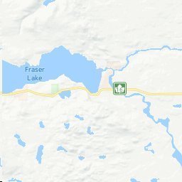
Smithers, BC to Quesnel, BC. 270 miles. 18 June 2017
Animal sightings an route: Mama black bear and two cubs, my side of the road, one deer.
It had been my intent to not retrace my steps down the Gold Rush Highway (BC 97) that I had used to ride north to Prince George from Kamloops back on 05 June 2017. I would ride southeast on the Yellowhead (BC 16) past Jasper, BC trying to make Lake Louise, BC for the evening.
Ten years ago, riding with Elk and Joe, I had come on that route from the other direction. We had ridden past Smithers to our ultimate destination on that ride, Hyder, AK.
On an earlier ride, with Mr. Z3, I had stayed at the Post Hotel in Lake Louise. The Post Hotel is a great hotel and I wanted to see if it had held its standard since I had last visited.
I thought I had lost my wedding ring at the Post Hotel. I left it on a dresser (shouldn't have done this) before going out to dinner with Mr. Z3. I forgot about it until the next morning shortly before our departure. The ring wasn't where I had placed it. I couldn't find it after a more thorough search of the room. I gave the Hotel manager my contact information and asked him to notify me if my ring turned up. I didn't make any accusations. Three days later, as we were riding into John Day, OR, I heard my cell phone ring. It was the manager of the Post Hotel in Lake Louise, BC telling me that my ring had been found.
Earp wanted to get back to Walla Walla ASAP and the fastest way would be to get back would be to take the Gold Rush Highway, BC 97. So, we decided to split up. Earp was up and dressed at 6:00 AM. It was one thousand miles to Walla Walla. Considering his eagerness to depart, I excused him from breakfast and off he went. I wouldn't put it past him to do the thousand miles in one day.
My longest day ride was ten years ago. I rode from Monterey, CA to Park City, UT. 900 miles. I left Monterey at 5:00 AM and arrived in Park City at 9:30 PM. I was liberal with breaks. I stopped for a look at El Capitan at Yosemite and took a half hour lunch break at Tonapah, NV (US 6).
A talk at breakfast (Prestige Hudson Bay Hotel) with a Montana couple riding a BMW R1200 GS caused me to rethink my riding plans for the day. "Are you sure you want to ride down Lake Louise/Banff way? they said. "Its terribly crowded down there. That's the way we rode up."
Their suggestion made sense. Banff/Lake Louise is one of Canada's top vacation spots. It stood to reason that it would be crowded. I didn't want the hassle after over two weeks of almost daily motorcycle riding. I had horse-to-the-barn urge to get home anyway.
So, I decided to retrace my steps. I'd take BC 97 to... where? Williams Lake would be about 400 miles. Kamloops would be over 500 miles. Either one doable.
But, then I remembered.... Barkerville.
On 05 June 2017, on the way north, I was standing on the banks of the near overflowing Thompson River in Kamloops. I started up a conversation with another onlooker. He was a fifty something tourist from Vancouver, also fascinated by the high water.
After hearing about my itinerary going north, he said, "you should go to Barkerville. Its the center of the 1868 Fraser River gold rush. Its one of Canada's top tourist attractions.
I wouldn't have time to stop at Barkerville that day on my way north to Prince George. Getting to Barkerville required a fifty mile ride east from BC 97 at Quesnel... and back. A trip to Barkerville would require a four or five our deviation, minimum.
That's it. I would go to Quesnel (a timber town, 270 miles distant) for the evening, see Barkerville the next day, and then, ride on to spend the next evening at Kamloops. I could already taste the paneer curry that I would get at Nandi's in Kamloops.
But, first Quesnel and Barkerville... What was Barkerville, anyway, I wondered, not taking the time to look it up.
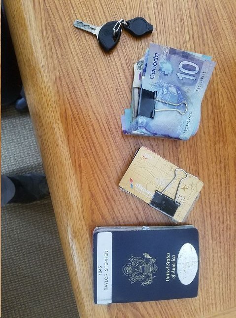
Above: My stuff at Quesnel Best Western Motel.
Which would be worse to lose?
I get a panic attack every time I reach into my pocket to retrieve one of this items. Is it there? Did I leave it someplace?
Had a chicken stir fry at Ulysses Restaurant in Quesnel.
Addendum:
Steve,
I love your blog and I have never been to that part of the world. Very interesting! Thank you!
ZIB,
New York City, NY
KOOL.
Mr. Z3, Ojai, CA
You know, Steve, your BMW is more photographed than any of the people in your life, even TIMDT.
Steel,
Atlanta, GA
Reminds me of the time while on a solo motorcycle ride fifteen years ago. I had stopped at a viewpoint on UT SR 72 to look at the Waterpocket Fold of Capital Reef National Park. A 30 something guy rides up on a BMW R1200RS, which happened to be the same kind of bike that I was riding. We got to talking. He said, "I'm from Grand Junction, Colorado. Last night my girl friend told me, 'You're not going on that ride tomorrow. Its either that bike or me.'"
Steve you are truly something else!!! Do you ever stop?? Margaret I wear the lovely shawl you gave me and think of our days together. The photographs look beautiful.
Love Saker
Mumbai, India
AMAZING Ride and scenery!!!
Is the ski area still open?
Ride safe
Montage, Marina del Rey, CA
No. Closed for the season. Most of the snow was gone. Surrounding dirt roads were dry. It was definitely a Spartan operation compared to what we're used to here. Hats off to the locals for making it work.
19 June 2017 - Today, starting in Quesnel, BC, I visit Barkerville, BC, ground zero of the great Caraboo Gold Rush, and then continue southward towards home with tonight's destination of Kamloops, BC.
Milage is over 400 miles; 100 of those miles will be out and back to Barkerville (BC 26) from Quesnel (BC 97).
Note: This is big country. I'm still 600 miles from the US Canada border, notwithstanding being well on my way home.
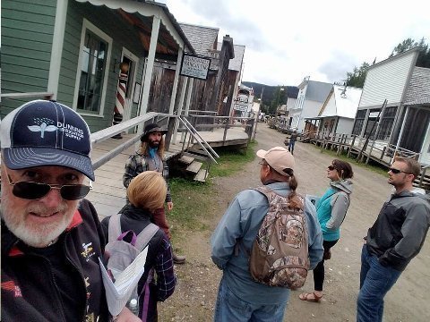
Above: Bishop listens to "Richard Goldsworthy" at Barkerville, heritage site of the 1862 Caraboo Gold rush. 19 June 2017
In Smithers, yesterday, at the hotel, Bishop was talked out of continuing southeast to Jasper, Lake Louise and Banff by couple from Missoula riding a 1200 GS. "Real busy over there," they said.
So, I opted to ride south, back the way I came up. BC 97, the gold rush route, to Kamloops. I stopped for the night in Quesnel.
Today, I rode the 50 miles east from Quesnel, BC 26, to get to Barkerville.
Barkerville, named for the English miner, Billy Barker, who struck the mother lode here in 1862. The greatest creek-side golf nugget deposit the world has ever seen.
"If you can't keep up with a gold rush, you'll never catch it." Billy Barker, 1862.
Barkerville claims to be largest heritage site in North America..ie. bigger than Colonial Williamsburg.
70% of structures are original.
Speaking to our group is the doppelganger of Richard Goldsworthy, the fifth miner to arrive at Williams Creek in 1862.
"Goldsworthy" looks the part, carries a bottle of hootch, and speaks in period dialect.
"Richard" died in the 1868 fire that destroyed Barkerville.
Great performance by Richard!
Barkerville. Very much worth the detour! A good place to take young people for them to get a flavor of the challenges of life in the west just over a century ago.
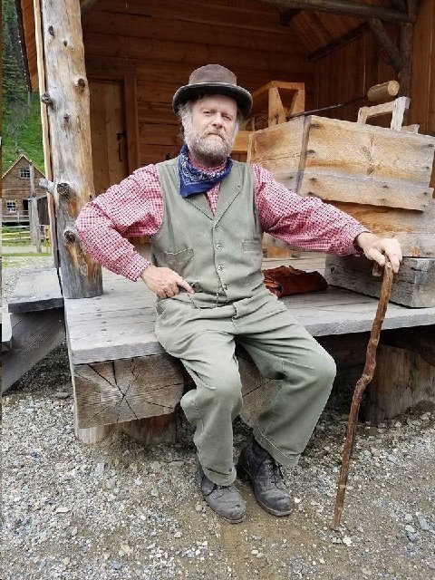
Above: Billy Barker (doppelganger). Barkerville, BC. 19 June 2017.
"Billy," actually a retired BC judge playing the roll of Billy, poses for the Bishop's camera.
At the very site of Billy Barker's motherlode discovery in 1862, "Billy" presented the story of his life.
Newly married British waterman jobless; railroads replace his trade.
Migrates to CA in early 1850s looking for god.
No success in gold, but learns a lot about prospecting and survival.
Goes to BC in 1859 to prospect for gold.
Wife in UK dies of cancer. Never sees his young daughter again.
Works his way, prospecting, up the Fraser River.
Finds the mother lode at bedrock 60 feet deep off of Williams Creek.
Biggest find in the Caraboo rush.. 1 oz gold each three pans dirt.
Town founded at Williams Creek in 1863. Barkerville.
Remarried. Settled Victoria, BC
Made bad investments. Broke by 1880. Wife dies cancer.
1880's resumed prospecting in Beaver Pass, BC.
1894 died a pauper living in a boarding house in Clinton, BC.
Great grand daughter visits Barkerville 1990's. "Billy" proud of her.
Like "Richard Goldsworthy" earlier, "Billy Barker" gave a wonderfully theatrical recitation of his life.
I applaud the effort that went into Barkerville's doppelganger meme as a way of familiarizing visitors with this exciting time in history.
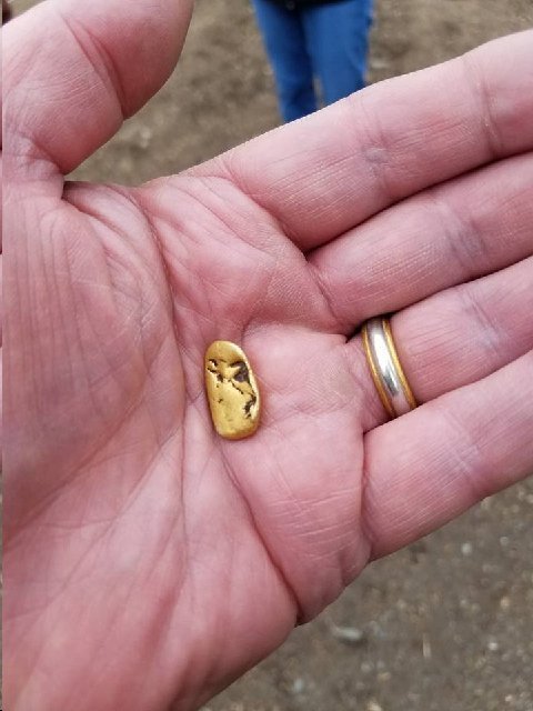
Above: Gold nugget from Barkerville, BC. 19 June 2017.
"Richard Goldsworthy" passed this nugget around to his tour goers, indicating that it was representative of the types of nuggets Billy Barker and other prospectors found in the deep gravel at Williams Creek.
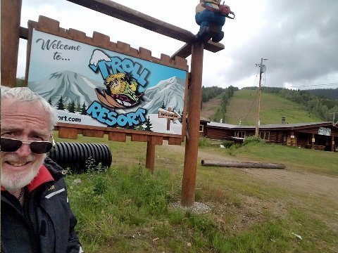
Above: Bishop poses at Troll Resort. BC 26 between Quesnel, BC and Barkerville, BC. 19 June 2017.
Stockli and Guzzi, if you ski here I'll buy your ski passes.
Owner, a forty five something woman, came out of her home as I was riding around her property.
Seeing that my intentions were harmless, the owner was happy to engage in conversation.
She and her sister had inherited the ski property, over 500 skiable acres, from her father.
Her married sister lives in Salt Lake City and is a regular skier at 'Bird. Her sister and her husband are moving to Troll Resort this year to help manage the property/business.
Troll Resort:
500 skiable acres
1200 foot vertical
4 T bars, longest is 2 km.
40 trails
No snow making
Three new Bombadier groomers
500 skiers on a good weekend day
Three meters snow fall in average year.
Most customers from near by Quesnel
I am fascinated by the proliferation of ma and pa ski resorts I see around BC and the western US. I'm wondering if there isn't an entrepreneurial opportunity to organize tours to these places... you know, for the skier who think's he's done it all?
If you actually wanted to ski Troll, you could fly to Prince George from Vancouver then drive 120 miles to the resort. There is a good Best Western Plus motel in Quesnel, 25 miles away.
Animal Sightings
Riding along BC 26, back towards Quesnel, just after the Troll Resort, I came upon a full sized black bear slowly ambling across the road. After checking my rear view mirror, I slowed to a crawl. I didn't want to get to close.
I've have now seen perhaps a dozen black bears on my trip to date. I regret not getting any images. I was properly warned last year by John Galt about dangers of stopping, while on a motorcycle, to take pictures of bears.
A Go Pro camera might be a good idea were I serious about wildlife photos while riding.
Many of my best wildlife sightings have been while on motorcycle trips. Humpback whales at Guerro Negro, Mexico. Wolf crossing the road, Yellowstone. Brown bear cub near Liard, BC. Herd of elephants crossing the road, outside Chobe National Park, Botswana.
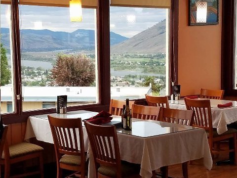
Above: Kohinoor Restaurant. Kamloops, BC. 19 June 2017.
I had been looking forward all day to a paneer curry at Nandi's. Closed Monday! Drat1
But, wait! Another Indian Restaurant is down the street, also with good views of the swollen Thompson River.
Passed on the paneer. Chicken biryani, instead. Excellent.
Addendum:
Hell of a ride Steve. As usual your photography and commentary is superb. It's like a virtual ride without the mud, the dirt and the weather! I'm there as soon as they pave the Dalton. I hate getting the GT muddy. By the way the replacement GT is better than the original. I hope to share some tarmac with you this year.
ITYW,
San Angelo, TX
I'd like to. Let me look at calendar. Maybe rendezvous midway.
Hi SDT
I enjoy reading diary immensely and I seldom if ever miss one (admittedly sometimes delayed). Very informative and interesting.
Thanks for proxy traveler access.
Yrs,
Bean Counter, Coral Gables, FL
Great human interest from your trip….I remain envious of your trips to remote areas never seen by most of us. River cruises afford us non motorcycle riders a snippet of what you experience on these trips.
Awesome trip/experiences. Thanks for sharing your adventures.
'Cake, Park City, UT
Thanks.
Brand, Ventura, CA
On 20 June 2017 I rode the BMW F800GS motorcycle back into the United States. Kamloops, BC to Spokane, WA. 333 miles. This is a beautiful ride with two memorable segments:
1. Riding south on BC 97 along the shores of Lake Okanagan through Vernan, BC, Penicton, BC, Kelowna, BC and Osoyoos, BC. This area had an aura of industriousness and prosperity. The vineyards between Kelowna and Osoyoos were beautiful in their symmetrical green rows... close up and at a distance.
2. Riding east on WA 20 from (a tisket) Tonasket, WA to Kettle Falls, WA. The road starts in obscure, rolling ranch lands, climbs through spruce forest, along streams, to Stewart Pass, then descends to the Columbia river (Roosevelt Lake). Today's ride was the first time I had ridden this road segment.
I spent the night at the Best Western Plus in Spokane, WA.
On 21 June 2017 I rode from Spokane, WA to Boise, ID, 426 miles. Three memorable segments on this ride.
1. US 195 from Spokane, WA to Lewiston, ID through Washington's Palouse farm land. Palouse means "lawn" in French (the actual French spelling is Pelouse). The name of this area is apt as there are now rolling fields of green wheat seen in all directions... a spectacular and unique site. This is some of the most fertile farming area in the US. The top soil in the Palouse is fifteen feet deep at places.
2. US 95 from Lewiston, ID to McCall, ID. The spectacular 2000 foot descent into Salmon River Canyon. The steep descent into the bottom of the canyon reminded me of a similar river canyon descent in in 2008 when I rode a Honda Africa Twin motorcycle in a 3000 foot descent into Blue Nile Canyon in Ethiopia.
3. ID 55 from McCall, ID to Boise, ID following roaring, white water, Payette River. Class five rapids for thirty miles. I didn't see any kayaks or rafts... probably for good reason: really raging high water.
I spent the night of 21 June 2017 at the Bond Apartment Hotel, Boise, ID. Ugh (scroll).
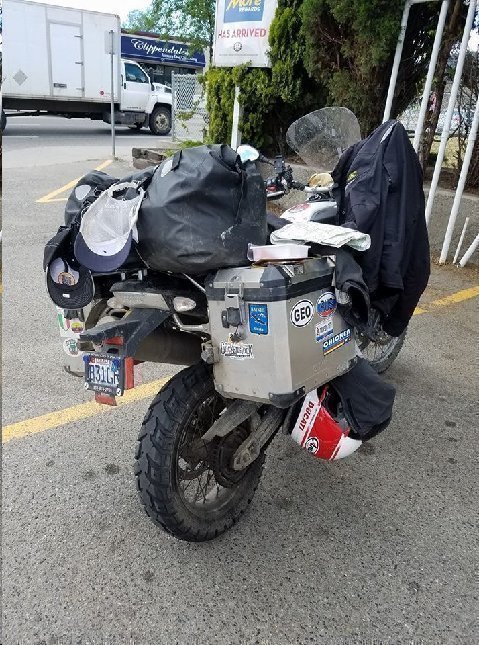
Above: BMW F800 GS. West Kelona, BC. 20 June 2017.
Rest stop. Gas. Snack.
Rubber on this Hidenau rear tire looks good after 5000 miles of riding. I could probably ride this rear tire safely to 8000 miles. On my Duc Multistrada, I ride on Pirelli Scorpion trail tires. I can't get more than 4500 miles on the rear tire.
Other bike functions performing fine. I've been lucky that the F800 GS has not had mechanical issues during the trip. In the built up areas where I'm riding now, it wouldn't be difficult to find a tow truck and/or motorcycle mechanic should something mechanical stymie the ride. Knock on wood.
Invariably, on a trip like this you run into riders who have been waylaid by mechanical problems. Oddly, in the last two years of riding in BC, YT and AK, the waylaid riders I have run into have been Germans. Last year was the German, riding an F800GS on Hidenau's, like me, who had a ruined rear tire. He was holed up in Toad River, BC on the Alaska Highway waiting for a new tire to be shipped from San Francisco.
And, then, remember this trip, in Teslin, YT, the German couple riding the '95 BMW PD with the disabled starter. They'd always have to park on a hill, or, after getting fuel, ask for help with a push. They had had a new starter shipped from Denver to Dawson, to await their arrival there.
Up in northern BC and YT where points of civilization are separated by a minimum of 150 miles... with no cell service in between, I might have no other option other than to abandon the bike by the side of the road and hitching a ride as a "resolution" to any serious mechanical problem.
As I say, fortunate, if not lucky... re mechanical incidents.
Stories along the road.
Bishop at Spencer's steakhouse in Spokane, WA.
At bar. Ribeye and Malbec. Mushroom and broccolini sides. First class prime steak (hat tip Big Data Social Security deduction) and service.
Regional sales manager for Kenworth, from Seattle, on the left, geezer man and wife of a certain age, pension fund contract auditors, both CPAs, from Great Falls, MT, on the right.
Bishop asks question to female bartender: What's happening in Spokane besides John Stockton and Gonzaga basketball?
After laughter around the bar subsides, Kenworth says, raison d'etre for Spokane is agriculture.
Peterbilt and Kenworth have same owners (public), but still view one another as competitors. Kenworth produces 300K new copies a year. Average MSRP for tractor: $120K. Peterbilt and Kenworth have 25% of market between them. Highest share? Freightliner. "One of my biggest customers is SLC's C. R. England. I go to SLC all the time." Owner operators of single trucks diminishing as percent of total market.
Pension Fund Auditors: 10 years ago, employers used to cheat the pension funds. Not so much today.
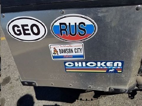
Above: BMW F800 GS's right pannier. Lewiston, ID. 21 June 2017.
The stickers remind of TIMDT's and Mwah's (sic) motorcycle ride (BMW R1200 GS) through Georgia and into Russia (also Armenia, Azerbaijan, and eastern Turkey) in 2014.
The lower two stickers are from stops on this ride. Dawson, YT and Chicken, AK.
Lewiston, ID is where the Clearwater River and the Snake River conjoin (both rivers taken by Lewis and Clark). Lewiston, named for Meriwether Lewis, is a "port" city where farm products, mainly wheat, are loaded onto barges which make their way, via the Snake River, to the Columbia River at Tri Cities.
One doesn't think of Idaho having a port city with navigable access to the Pacific Ocean.
Its hard, in fact, to come up with one identity for the state of Idaho.
Here in Lewiston we are in farm country, part of the same fertile area as Washington's Palouse. Lewiston, in fact, may see itself more part of the Washington farm economy than any place in Idaho as it is the only part of Idaho which is in the Pacific time zone.
Further to the northeast is the Idaho Panhandle which area seems to have more in common with forested areas of the northwest US and British Columbia.
Central Idaho is Rocky Mountain craggy and remote. Squint in Sun Valley and you might think you are in Aspen or Telluride.
Southern Idaho with its deep Mormon heritage and farming/ranching economy seems to have more in common with Utah than with any other portion of Idaho.
Boise the capital. Latte town. Voire Boulder, CO, Madison, WI. Patagonia bobos.
Idaho reminds me of Florida which is also distinctively segmented regionally.
Florida doppelgangers:
South Florida: New York City, Rio de Janeiro
West Coast Florida: Chicago, Minneapolis
North Florida: Dallas, Birmingham
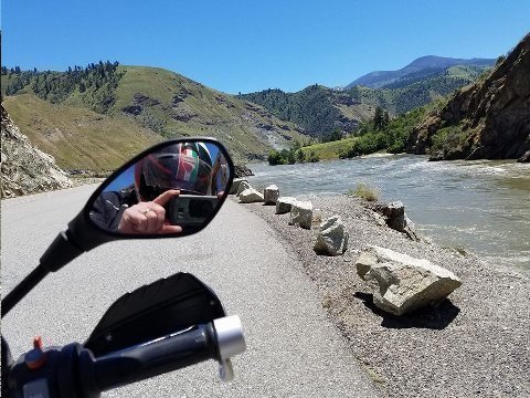
Above: Salmon River. US 95, Idaho. 21 June 2017.
Ten miles north of Riggins, ID
The Salmon River will flow into the Snake River, seen earlier in the day in Lewiston, ID, about 20 miles north of this point. Both rivers here are flowing northbound, parallel to one another, only eight miles apart. The Snake, to the west of here, is flowing through Hells Canyon National Recreation Area. The western side of Hells Canyon is in Oregon.
Throughout my trip the flow of all the rivers I have seen has been robust.
The Thompson, in southern BC, a tributary of the Fraser, was overflowing its banks ten days ago when I was there.
The spillways at St. Joseph Dam on the Columbia River were maxed out when I saw the dam two weeks ago.
The Yukon and its tributaries, the Stewart and the Pelly, were flowing to the brim.
Paradox. In BC, Yukon and Alaska, there is water, water, everywhere, yet, no population. In the southwestern United States there is relatively little water to supply one of America's most populous regions.
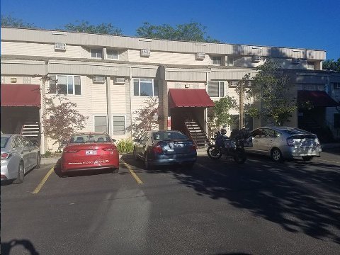
Above: Bond Hotel. Boise, ID. 21 June 2017.
Boise has always been a difficult town for me to orient myself. I had an orientation melt down of sorts in Boise today.
I didn't have reservations in Boise, so I stopped at a Starbucks in Eagle to search for a motel/hotel on my device.
There were no Best Westerns near down town, and the Best Western Plus in Meriden was sold out.
I went to Expedia. I wanted to go downtown. Maybe I could find a good steakhouse near the hotel, find some conversation at the bar, and get a few walking steps in before I went to bed.
The Bond Hotel popped up as a downtown hotel with a discounted room price. I booked the Bond Hotel with cavalier, serendipitous, insouciance.
I had a hard time finding the place. Did I mention that my Garmin had popped out of its holder a couple of days ago on BC 97 near Kelowna? So, sans Garmin I went to my next navigation option. I entered the Bond Hotel address into my Google Navigation on my phone, but, I had no way of monitoring the route as I rode since I had to keep the phone in my jacket pocket. Ear phones and a cord might have made using the Google navigation easier... but, I was unprepared in this regard.
So, I would have to stop, check the route, start out, stop again when I thought I had reached an intersection way point, and so on.
This stop start method didn't work very well, and because of my lack of orientation in the city, and, because I thought the hotel was "downtown" as was mentioned in Expedia, I spent twenty or thirty minutes making wrong turns.
Finally, I gave up on Google Navigation and, while stopped on a side street, called up Google Maps to find an actual map showing where I was and where the hotel was.
The Bond Hotel was not "downtown." It was on the periphery of downtown... in a residential neighborhood. It was less a hotel and more an extended living apartment hotel. It looked pretty run down for even the "discounted" the price I had agreed to with Expedia.
I walked into the office. There was a young man wearing cargo shorts, seated in a dented up folding chair with his sneaker shorn feet up on a scratched up, cluttered, Office Depot special, steel desk. The kid had his face in his device. Though I was the only customer in the cluttered office, he didn't look up from his handheld until at least thirty seconds after I came in.
He had my reservation on his computer.
"I'm going to put a $300 hold on your credit card," he said. I don't know about the amount, but, I thought, "pre authorizations" are standard procedure for hotel check-ins. However, the surly way he mentioned it and the disorganized and less than professional nature of the office got me to wondering whether I was being set up. Would I get charged $100 for a "lost" hotel key, say?
"Your room is either in the first or second building in "that direction," he said, after handing me a standard brass key.
I paused... I didn't remember seeing more than one building... the one we were in. "I didn't see any building other than this one," I said.
"Well," he said pointing, "your room is that way... I'm not sure what floor its on."
"Is there a restaurant within walking distance?" I asked.
"Uh... there's a Mexican Restaurant a couple of blocks down that way (he pointed to the main road I had ridden in on). Its open 24 hours."
My room was on the ground floor just next to the office. There was only one building as I had remembered as I had parked my bike, but there were several sections of the building, each with a ground floor and a second floor apartment unit. The building and my bike are in the image accompanying this narrative.
After unloading the motorcycle and getting my stuff transferred into a dark, dingy, well worn suite room, I walked off looking for the twenty four hour Mexican restaurant.
Much closer to the hotel than two blocks, was a 24 hour Mexican restaurant that was empty... boarded up. I thought, well, maybe these people moved to another location closer to the "two blocks" the hotel guy had indicated. Why would the kid, I thought to myself, send me to a boarded up restaurant?
I walked five blocks and found nothing.
The street where I was making my search intersected Orchard Road, a fairly important thoroughfare in Boise. I looked up the road and within the half mile range there appeared to be some commercial establishments.
In fact, about a half mile up there was a Chinese restaurant, Star Restaurant.
I went into Star Restaurant on Orchard Road. It was pretty crowded. The restaurant interior looked like it had been last renovated in 1947.
I ordered steamed rice, Kung Pao chicken, chop sticks and a rice bowl. The food wasn't bad.
After eating, I walked about a mile back to the Bond hotel and went to bed. In a way, I was glad that TIMDT wasn't with me at the Bond hotel. She would have lain awake all night on top of the bed with all of her clothes on, not enjoying the stay at all.
Addendum:
Steve quite fascinating. Two Indian restaurants in Kamloops, BC!!
Happy journeying.
Saker,
Mumbai, India
I always enjoyed thoroughly the area you were writing about today; we had some super times and great Five-star meal’s at Post Hotel, I still remember you finding the lost wedding ring. I can remember that the individuals working in the hotel knew us by name, as did a few of those Black bears. -:)
Mr. Z3,
Ojai, CA,
22 June 2017 - I expected to take I-84 and I-15 to Harrison Motorsports, Sandy, UT, where I would drop off the bike for service, tires, and general refitting after a 6000 mile ride. TIMDT said she'd pick me up. We'd go somewhere for dinner - probably 'Cheese - and then home to Park City. Distance Boise, ID to Salt Lake City, UT: 350 miles.
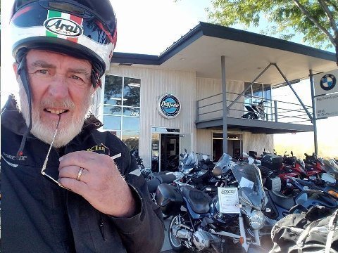
Above: Bishop at Big Twin Motorcycles, Boise, ID. 22 June 2017.
There was a McDonald's on Orchard Road as I rode the BMW F800 GS motorcycle north from the Bond Hotel to I-84 and the route home. Today's ride would be just a short 350 miles to the BMW motorcycle dealer in Salt Lake City UT, where I planned on dropping the bike off for service and new rubber.
I stopped for a sausage biscuit with egg and a coffee. By the time I had finished breakfast and gotten back on the road, it was about 9:00 AM when I came to Big Twin Motorcycles, at the intersection of Orchard Road and I-84 - opening time.
I don't know anyone at Big Twin today, but, Big Twin figured strongly in my early motorcycling days and I have always held an affinity for them, usually taking the time to stop by when I'm in Boise.
Big Twin had just opened, so, I stopped.
Last year while at Big Twin I asked a parts guy if they had a BMW tank bag for my 2012 F800 GS motorcycle. I've learned to do without tank bags... I stuff my pockets with pressure gauges, ear plug holders, maps, multitools etc. as a substitute for a tank bag. Big Twin didn't have a tank bag in stock. So, I rode on without one.
Today, Big Twin had the right tank bag in stock. But, it would have taken thirty minutes or more to get in installed... you have to take of the seat off... yada yada... and I was in a hurry. So, impatient as I was to get going, I didn't buy the bag.
How does Big Twin figure into my motorcycling life?
In 1997 TIMDT and Mwah (sic) bought a second home in Park City. We call it the "Yellow House." We own and rent out the "Yellow House," in Park City's Old Town, to this day.
In 1998 we decided to start spending more time in Park City at the Yellow House. I was working a job in Phoenix, AZ. I had just purchased a BMW R1100 GS motorcycle at Iron Horse Motorcycles in Tucson, and I decided that I would ride it to Park City and keep it there.
The ride from Phoenix to Park City is about 750 miles. When I arrived in Park City, after a great, scenic ride, the new bike was due for its 600 mile check up at a BMW motorcycle dealer.
I called BMW of Salt Lake, then located on 35th South near Redwood Road, and asked for a service appointment. I didn't know anyone there, so I just asked for the service department.
The guy at the other end of the phone said, "Look buddy. We're flat out. We can't get your bike in here for another three months."
"Whaaaa?!!" I exclaimed. "I can't ride the bike and stay within the warranty if I don't get it serviced!"
"Sorry," he said. "We can't help."
"How do I get the bike serviced?" I asked.
"We'll" the BMW of SL guy said, "why don't you take it up to Boise's Big Twin Motorcycles?"
The idea seemed far fetched... but, the prospect of a motorcycle ride to Boise also stimulated my wanderlust. I had never been to Boise. Why not check it out?
I called Big Twin. "Sure," their service representative said, "we can do the service any time. Bring the bike in. We'll give you a loaner motorcycle to ride around Boise while we do the service."
Talk about a difference in approach from one dealership to the other!
Well... that's what I did. I rode the bike up to Boise, via I-84, to get it serviced. As a fairly new motorcycle touring aficionado, I rode through my first heavy rainstorm between Snowville, UT and Burley, ID. I had hoped to get to Boise in one day... I had only 350 miles to cover... but, I was soaked, not having prepared for rain, so I stopped in Burley, 150 miles from Boise, to dry out. I spent the night in Burley at a Best Western motel.
The next day everything worked well. I left Burley early, was in Boise by 9:00 AM, and delivered the R1100 GS to Big Twin. I took Big Twin's loaner bike, a Triumph Bonneville, for a spin around Boise, and then picked up my serviced "GS" later in the afternoon. I rode forty miles to Mountain Home, ID, stayed the night, and rode home the next day.
The notion of taking a vehicle 350 miles (700 mile round trip) to get it serviced seems pretty far fetched. But, it happened and I had a pretty good time in the process.
Still, looking to the future, I couldn't let the fact that I would have to wait three months to get a bike serviced at my local dealer unaddressed.
Some Park City riding friends said I should talk to the owner of BMW of Salt Lake to complain about getting stiffed on the service appointment. They made an introduction.
I told the owner my story and he was aghast, honestly so, it appears in hindsight. He said he talk to the employee who gave me the bum's rush and make things right in the future. He lived up to his promise and things were "right" with BMW of Salt Lake thereafter... until this day, 20 years later, after three additional dealership ownership changes.
The then owner of BMW of Salt Lake is now a salesman at Salt Lake's Dave Strong Porche. He's sold me two Cayenne's since he's been there.
But, one can see, I think, why I have a special affinity for Big Twin in Boise, ID. I've bought tires and clothing there, stopping by many times over the years since that iconic service appointment in '98.
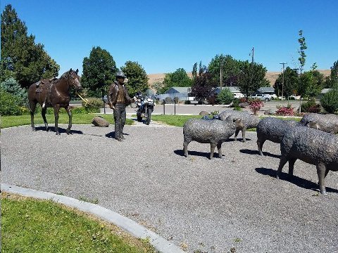
Above: Hagerman Sheep Monument, Hagerman, ID. US 30. 22 June 2017.
I-84 follows the Snake River across the state of Idaho. The Snake River for much of its Idaho flow, established the route of the Oregon Trail.
Before, I-84, US 30 was the way to travel east or west, following the Snake River, across southern Idaho.
Despite the presence of I-84, US 30 has been kept active. The route parallels I 84 and tracks through small towns and the fertile farmland of the Snake River plain.
US 30 is a slower route. Speed limits are lower...max 65 mph compared to I-84's 80 mph. And, towns along the way periodically slow the rider to in-town speed limits.
But, I was feeling curious. I had ridden US 30 a couple of times west of Twin Falls, but never east of Twin Falls. Now was a chance to have a new riding experience. I'd delay my arrival home by one or two hours, depending on what I stopped to see, but, I might not have another opportunity to check out this area.
I stopped at the Hagerman Sheep Monument.
Here's an excerpt about the Hagerman Sheep Monument from the Hageman Chamber of Commerce:
In the late 1800’s, sheepherders in the Idaho Territory worked in the Hagerman Valley. The majority of sheepherders were Basque. A herder and his Australian Shepherd or Border Collie sheepdog could handle a band of 1,500 to 2,000 sheep.
The Hagerman Valley was an attractive wintering location for sheep ranching because of plentiful year-round spring water that didn’t freeze due to milder winters and protection from harsh early spring storms during lambing. In addition there were many acres of irrigated land that produced alfalfa and grain for winter feed.
An inscription on the monument reports “In 1882 the Oregon Short Line arrived in Shoshone and Bliss. This provided a means of getting wool and sheep to market which led to enormous growth in sheep numbers. Bliss became a major shipping center for the Jarbidge and Three Creek areas, and had a large shearing plant. A branch line was quickly extended to Ketchum and Hill City by 1884. By 1914 over 300,000 sheep were being trailed through Ketchum. Hill City and Ketchum were two of the largest sheep shipping centers in the U.S.”
The monument was dedicated in 2013. For Dennis the Menace's benefit, my bike can be seen parked amidst the bronze cast sheep!
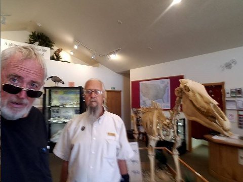
Above: Bishop, docent Richard, and 3.5 million year old Hagerman Horse (plaster cast). Hagerman Fossil Beds National Monument visitors' center. 22 June 2017.
Hagerman Fossil Beds National Monument is the preeminent location in North America for fossil species from the time period called the Pliocene Epoch... 2.6 to 5.3 million years ago... relatively recent on the geologic time scale. The dinosaurs disappeared from the earth during the Paleocene era, 65 million years ago, to put the Pliocene in context.
The fossil beds were exposed by major flooding through the Snake River Valley 15,000 years ago, when land gave way at nearby Lake Bonneville. The residual lake of Lake Bonneville is the Great Salt Lake.
The best known species discovered at Hagerman is the Hagerman Horse, a zebra like ancestor of today's horse, and one of the first early horse like specimens to have a one toed hoof. 20 complete skeletons of the Hagerman Horse were retrieved. One fossilized skeleton is on permanent exhibit at the Smithsonian Museum in Washington, D.C. Hagerman is the only fossil sight in the world where specimens of the Hagerman horse have been found, along with seven other species exclusively located here.
Climate change? During the Pliocene this area was a grassy plain with ponds and forest stands which then received over twice today's 7 to 10 inches of annual precipitation.
Evidence of other animals at Hagerman include saber-toothed cats, mastodons, camels, ground sloths, hyena like dogs, beavers, muskrats, otters, antelope, deer, fish, frogs, snakes and waterfowl.
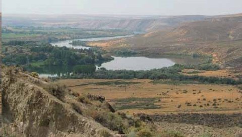
Above: Hagerman Fossil Beds National Monument. File image. 22 June 2017.
The image looks east. To the right of the Snake River are the flood eroded bluffs where the Pliocene era fossils are exposed.
There is a permanent team of National Park Service employed geologists which continue to explore the fossil beds.
Travel and learn!
This little visited National Park's site was fascinating. My serendipitous decision to take the US 30 back road has paid off by providing some very interesting stops, so far, along the way.
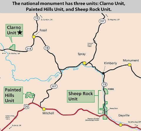
Above: Map. John Day Fossil Beds National Monument, Clarno Unit, near Fossil, OR.
Earlier on this trip, on 03 June 2017, I stopped at John Day Fossil Beds National Monument, Clarno Unit, in Oregon. That day, I had started my ride in Ashland, OR with a destination of Walla Walla, WA where I would stay with great hosts, John Galt and Dagny Taggart.
Clarno Unit fossils were found in exposed mudflows that formed 54 to 40 million years ago in the Oligocene period, a lush semi-tropical rainforest environment. Species founded here include a four-toed horse, huge rhino-like brontotheres, crocodilians, and meat-eating crodonts.
I suffer from "exploding head syndrome" when I try to think about geologic time.
"Man," in close approximation to what the species is today, has been around for about ten thousand years... hardly a micro second when the earth's age of 4.6 million years is reduced to a hypothetical, twenty four hour clock.
Even the Pliocene, when the Hagerman Horse ran free, circa 3.5 million years ago is only a "minute" or so ago when measured on the 24 hour geologic clock.
The two fossil bed national monuments that I visited on the current "Alaska/Yukon Ride," both in the US, one at the outset and the other near the end of the trip, show periods separated by fifty million years!
One thing noted in visiting these geologic sites is the radical changes of climate and topography that have occurred over the millennia. We can't perceive it readily now within the miniscule time frames of our own existence, but, on the geologic clock, the earth continues in its evolutionary, creative, and adaptive process. One day, the Yellowstone caldera will blow. One day the Pacific tectonic plate will shift radically. One day another huge meteor will strike the earth, as occurred in the Yucatan, 70 million years ago. We live in a dynamic, evolving universe. Nothing stays the same.
It is inevitable that the earth, at some point, will become inhospitable for human habitation. Mankind's destiny, I believe, is to hedge its bets for survival by locating humans someplace other than planet earth. Hat tip: Elon Musk, Jeff Bezos, and Stephen Hawking.
The Hagerman Horse is no longer around today. The species failed to adapt to changing climate and the physical conditions of its environment. So, it is with any species... a species must adapt to survive. So it is with species mankind... adapt and survive.
As a corollary, trying to stop the evolutionary, creative, and climate changes of the earth is a fool's errand. Mankind is far away from understanding the forces that guide the earth's evolution, let alone those that govern the universe.
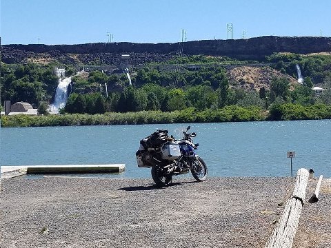
Above: Thousand Springs. US 30 west of Twin Falls, ID. 22 June 2017.
Water springs directly out of the rock into the Snake River.
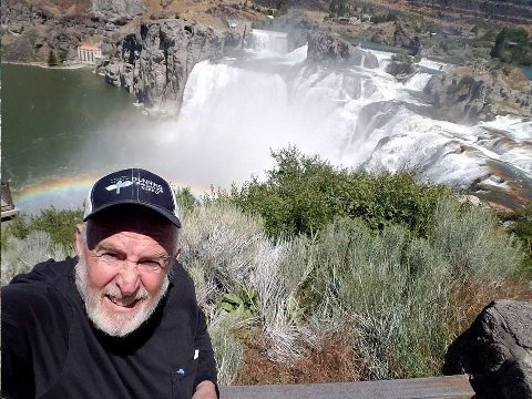
Above: Bishop at Shoshone Falls. Twin Falls, ID. US 30. 22 June 2017.
I was here late summer ten years ago when the falls were running at a trickle. I had to see Shoshone Falls at full bore, so I stopped. I wasn't disappointed!
At 212 feet, Shoshone is 45 higher than Niagra Falls. The falls was formed by the same catastrophic flooding outburst from Lake Bonneville, during the Pleistocene ice age, 14,000 years ago, that exposed the fossil beds where the Hagerman Horse was discovered.
20K cubic feet of water per second flows over the falls during Spring of a high run-off water year, such as this year. In a dry year, late summer, the runoff can be as low as 300 cubic feet per second. Much of the Snake's water is diverted before the falls for use in irrigation.
Seeing the burgeoning Snake, I was reminded, once again, of the high water I have seen everywhere throughout my ride.
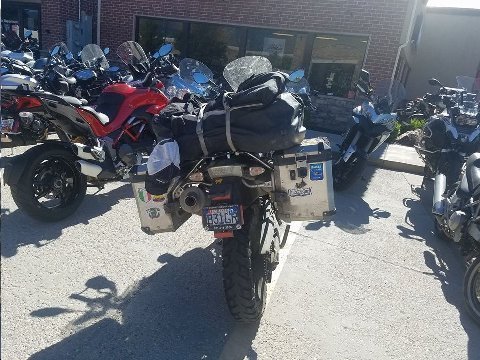
Above: BMW F800 GS at Harrison Motor Sports. Sandy, UT. 22 June 2017.
Finish.
Park City, UT to Dawson City, YT and Tok, AK and return.
6163 motorcycle riding miles.
350 Inside Passage ferry miles.
Addendum:
I will read "The Floor of Heaven ". You've got me interested. But I can answer your question about the American spirit. We do have a new paradigm. We are headed the way of Europe. Less initiative. Less self reliance. More a sense of entitlement.
Dennis the Menace,
Atlanta, GA
Agree... sadly. Hunker down. It was good living at the apex.
So Boise, Idaho was not your. Favorite stop, but the trip is fascinating.
Bridge,
Palm Beach, FL