Picto Diary - 25 September 2016 - Ashland to Winnemucca
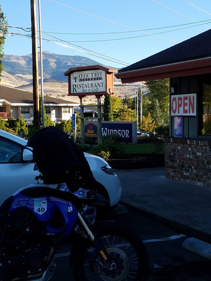
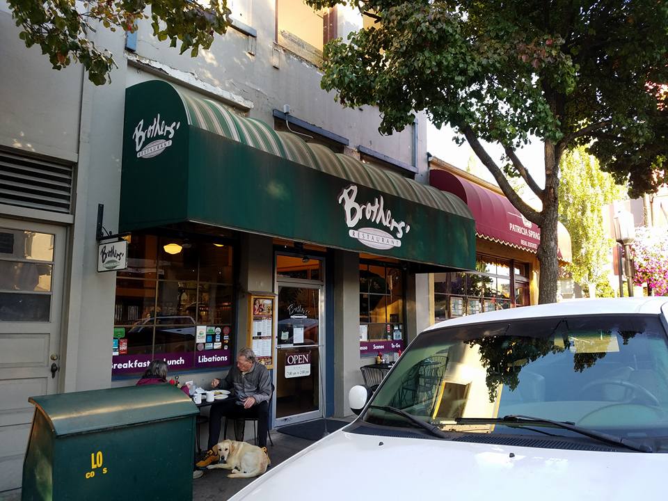
Above: Image 1: Oak Tree Restaurant, Ashland, OR. Image 2: Brothers Restaurant, Ashland, OR. 25 September 2016.
A tale of two breakfast restaurants.
Both serve pretty much the same breakfast fare... but, at opposite sides of town they are also on opposite sides of the American social divide. Charles Murray would know what I'm talking about. He is the author of "Coming Apart," a recent book which describes the increasing social divide in America. He notes in his book that individuals on either side of the American cultural divide rarely know, in a friendship sense, individuals on the other side.
Brothers, near the OSF theaters caters to the "educated class.".. mostly secular types. Theater people, retirees from the big cities, educators, members of the professions, and college students. Many of the servers wear tattoos and facial jewelry. There is no lunch counter.
Oak Tree Restaurant caters to a different set... a set more likely to cling to their bibles and guns. Customers are mostly blue collar, people who know how to do stuff... trades peoples, retired military guys, ranchers, cops, single working Mom's, sometimes with their kids. Oaktree waitresses are saucy "good morning, hon," types. There's a lunch counter for the single patron to use, if desired.
I eat at both places... both are good. However, I remind myself, its good - and interesting - to be friendly with people who know how to do stuff...the people who keep my clothes dry cleaned, unclog my toilets, to pave my driveway, and fix my motorcycles... the people who keep the country running.... the people who in the slow economy of the last 15 years or so, haven't fared so well.
This visit to Ashland I had breakfast at Oak Tree Restaurant all three mornings I was there.
Ashland to Lakeview. 160 miles. Images individually captioned. 25 September 2016.
Shakespeare numb. Rub my thumb.
Back on the bike. 'Swat I like.
Oregon quirk, to save lives.
70 roads, are 55s.
Still, two wheels, is where it's at.
Oregon bugs, Arai splat.
Pristine day, tempts faster pace.
Thank Lakeview cop, for his grace.
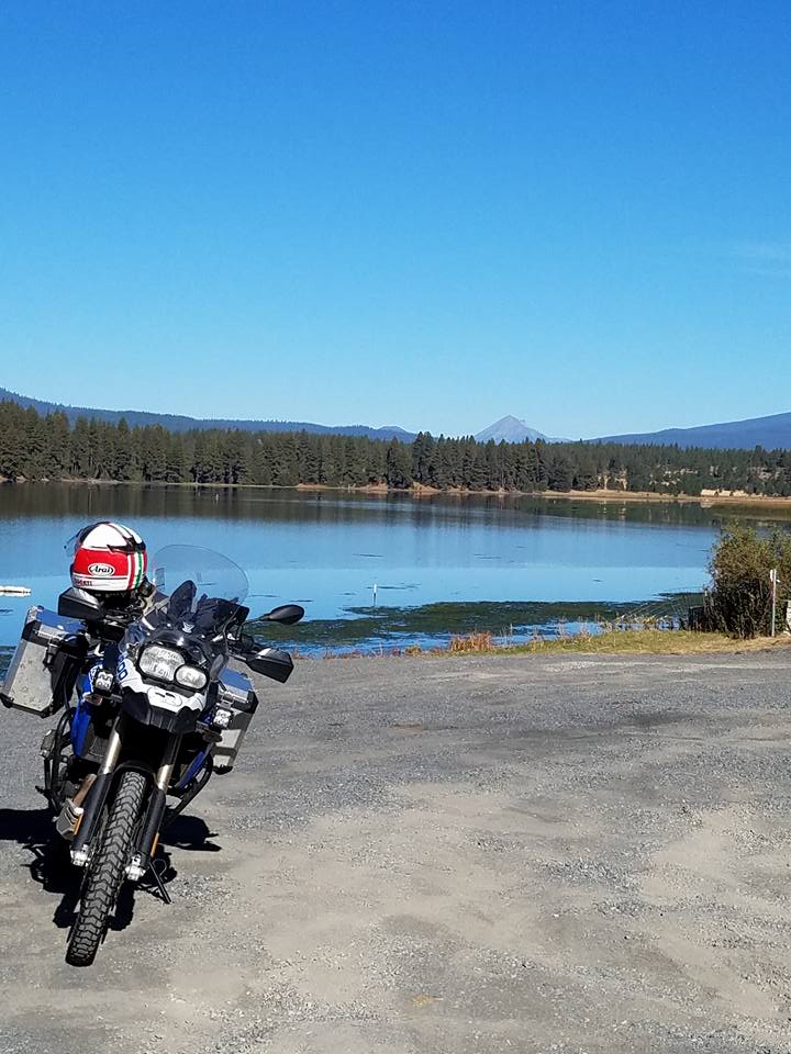
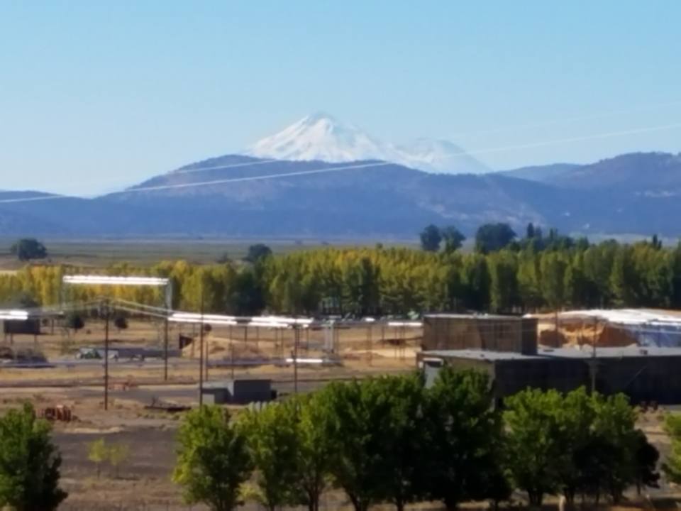
1. F800GS at Applegate Trail crossing of Klamath River. Mt. McLoughlin in distance.
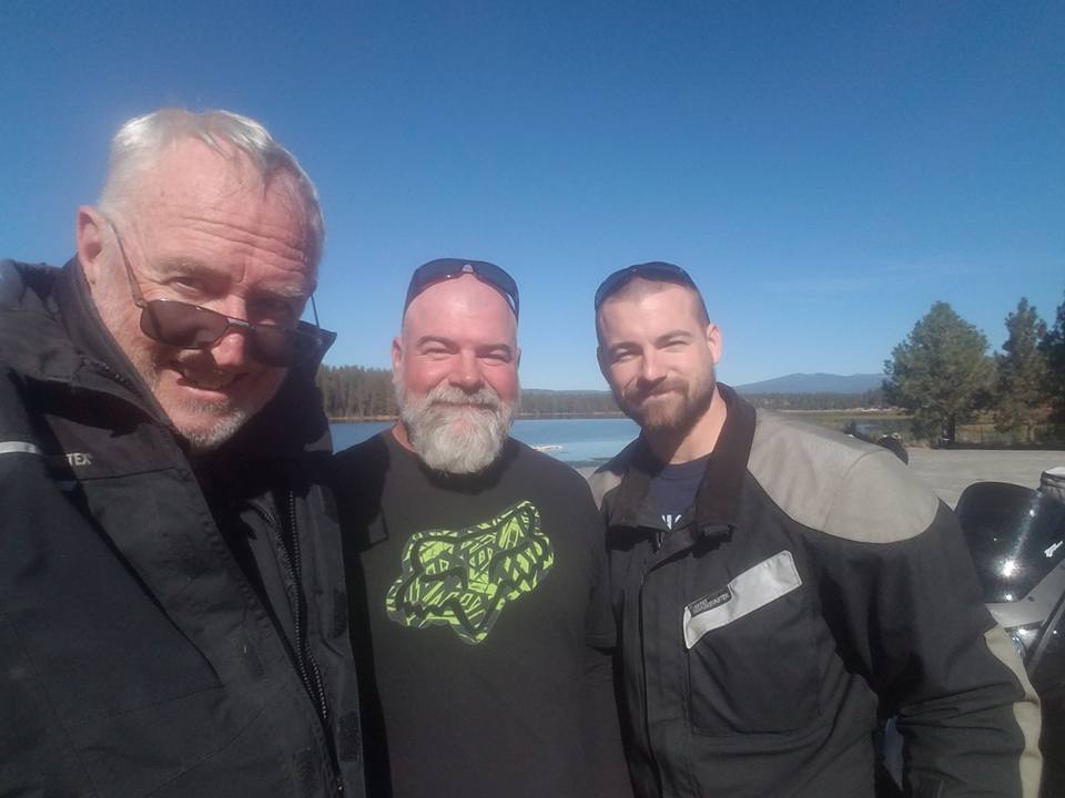
2, Bishop with two Davids... dad and son, from Klamath Falls, out riding their KLR's.
We talked about our bikes....how we all felt lesser powered, lighter adventure bikes provided more flexibility in the overall motorcycle touring experience.
We all expressed interest in Honda's new Africa Twin. I rode the old Africa Twin, never imported to the US, in Ethiopia circa 2008.
.
David Sr.: "Couldn't take Cal any more so moved to Oregon.
Got shot in my neighborhood in Richmond. Bad place. Had to get out.
Love it in Klamath Falls. My son and I found jobs very quickly."
Deplorables. Guys who know how to do stuff. Guys to know when the mud hits the fan.
3. It hasta be Shasta!
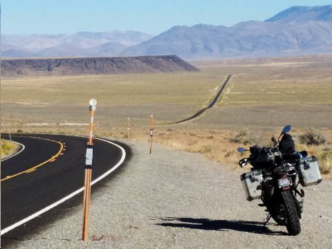
Above: Doherty Rim. Oregon SR 140. 25 September 2016.
The top of the rim is about 12 miles from the Oregon/Nevada State line (beyond the top of the rim as seen in this image).
Four days ago, on 21 September 2016, I was coming from the opposite direction (east to west) on this road segment. I ran into a snow storm on top of the rim.
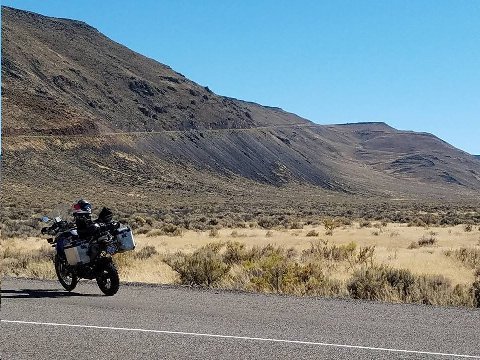
NV SR 140 cuts northwest from US 95, 25 miles north of Winnemucca. SR 140 carries another 80 miles to the northwest, though Great Basin Desert, to Denio Junction. Elevation through that 80 mile stretch is 4100 feet, but for a short 5800 foot pass, five miles before reaching Denio Junction. Weather through that stretch was overcast, with occasional holes in the sky where blue could be seen. No precipitation.
From Denio Junction, NV SR 140 turns almost due east and begins to climb. By the Oregon state line, the road has climbed over 2000 feet to reach a 20 mile stretch of 6200 ft elevation highway. The road becomes OR SR 140 after it crosses over into south, central Oregon.
When I reached the 6200 foot elevation level, the outdoor temperature started to decline. I had been riding in 50 degree temps, but at this higher elevation the temperature had declined to 40 degrees. A light ran began to fall. I didn't view this as a problem. I had about 15 miles to ride before the edge of Doherty Rim and a subsequent, quick descent, down the rim to 5100 feet and, assuredly, to warmer (fifty degree) temperatures.
To my surprise, as I neared the Oregon state line, still riding at 6200 feet, the outdoor temperature readout on the F800GS's instrument panel began to flash. The flashing means that the temperature is nearing freezing. I looked at the sky ahead. It was ominously dark... no "blue holes."
By the time I had reached the state line, the temperature had declined to 34 degrees. The light rain had turned to light sleet. There was no accumulation on the road, but my visor began to cover with sleet. I wiped off the visor's sleet with my glove and was good for another 10 or 15 seconds...while repeating the procedure time and again. I rode for another five miles under these conditions.
Five miles before the edge of Doherty Rim, the snow fall intensified. I was riding in a real snow storm! It was a wet snow. Snow started to accumulate on the road. I was alone. There was no traffic. None behind, none on coming. My visor wipe procedure stopped working. There was too much snow. The visor would occlude almost immediately after I would wipe it.
There was no shoulder to pull of on to wait out the storm. I had to keep riding. I slowed. I opened the visor a smidgeon, just enough to see through the slit separating the snow covered plastic visor and the face cover of the helmet. I slowed to about 40 mph and rode, in fourth gear, with as little torque as seemed possible under the circumstances.
I lost track of how much further I had to go to reach the rim edge. Feeling increasingly numb in the cold, all I could do was keep riding. After another mile or so the snow/slush, still very wet, began to accumulate in inches on the highway surface. I wondered how much further I could ride in these condition without slipping and falling.
I rode for another three minutes or so and finally came upon the big yellow warning sign announcing the 8 degree descent down Doherty Rim a half mile further. I breathed a sigh of relief... but, I still had a half mile to go on a snowy road that by now had accumulated a slushy layer at least two inches deep.
Finally, I reached the rim. I started my descent, and, as I had hoped, within 200 yards the snow fall had turned to rain and the road surface turned to wet, but not slushy/snowy.
I was now cold. I was dressed for 45 degree weather... not for 32 degrees and snow. I started to shiver. I wasn't wearing water proof gloves. My hands were cold, but not freezing thanks to the F800GS's heated grips.
I passed a snowplow coming up the rim edge road. He'd have some work to do... in September of all times... on this remote forsaken road.
I tried not to think what would have happened were I to have gone down.
At the bottom of the rim there was a turnout. I stopped, got off the bike, and started jumping up and down. I was shivering. A vehicle passed heading up the rim. I wondered if I looked stressed to the point that the driver might stop and check on me. The driver didn't stop. I told myself, "see, you're not in that bad of shape! Get on the bike and ride on!
I was about 30 miles from the tiny farming settlement of Adel, the first sign of inhabitation in Oregon when coming up OR SR 40. There was a store and a gas station in Adel. I resolved to stop there. But, I had forgotten about Blizzard Gap Pass, another rise to 6200 feet between me and Adel. Sure enough, I hit snow again, but, only briefly as the road descended quickly towards Adel after reaching the pass summit.
I reached Adel safely. I warmed up with a coffee, topped up the gas tank and rode on to Lakeview, another thirty miles, where I stopped at Jerry's for a bowl of hot clam chowder.
For a very brief period... eg. for the last two miles of the Doherty Rim ride... the snowfall was the worst I have ever ridden in. Slowly savoring my soup, I figured that I had dodged a bullet on Doherty Rim.
I can remember three other snow motorcycle rides, all experienced in the early 2000's. In order of seriousness, with the last being the most severe:
Donner Pass. Snow at the top of pass, not accumulating. Not terribly worried as I realized the snow would turn to rain after a mile or two of descent.
Rock Creek Canyon. Riding from Flagstaff, AZ to Sedona, AZ it started snowing, high up on the 2000 foot descent.. As I had hoped, or expected, the snow turned to rain after two or three miles of riding. No accumulation.
Julier Pass. Again, a mid September ride from north of St. Moritz over Julier Pass, to St. Moritz. This one was "dumber" than the first two. Why? Because i was ascending the pass, in the dark, without a good sense of how far I would have to ride before reaching the descent. I was lucky. i remember the driver of an oncoming, descending 911 rapidly flashing his lights as though to say, "you idiot, don't you know its snowing where your going?" The road stayed wet until about a half mile of riding over accumulating surface at the top of the pass. But, not near the accumulation that I experienced on the scary ride four days ago at the top of Doherty Rim.
Above: NV SR 140. 30 miles west of Denio, NV.
I love being out here! No one around. Timon would love it! Good place for a misanthrope!

Above: $100 in. $154 out. Wheel of Fortune slot. "Free dinner." I have a system.
Addendum:
We have one of those mini library stands one block over. Every time I go by I've been curious if anyone uses it.
Portland,
Salt Lake City, UT
I can not believe you are on the road again. Enjoy!
Bridge,
Palm Beach, FL